MyTopo
Barnes City Iowa US Topo Map
Couldn't load pickup availability
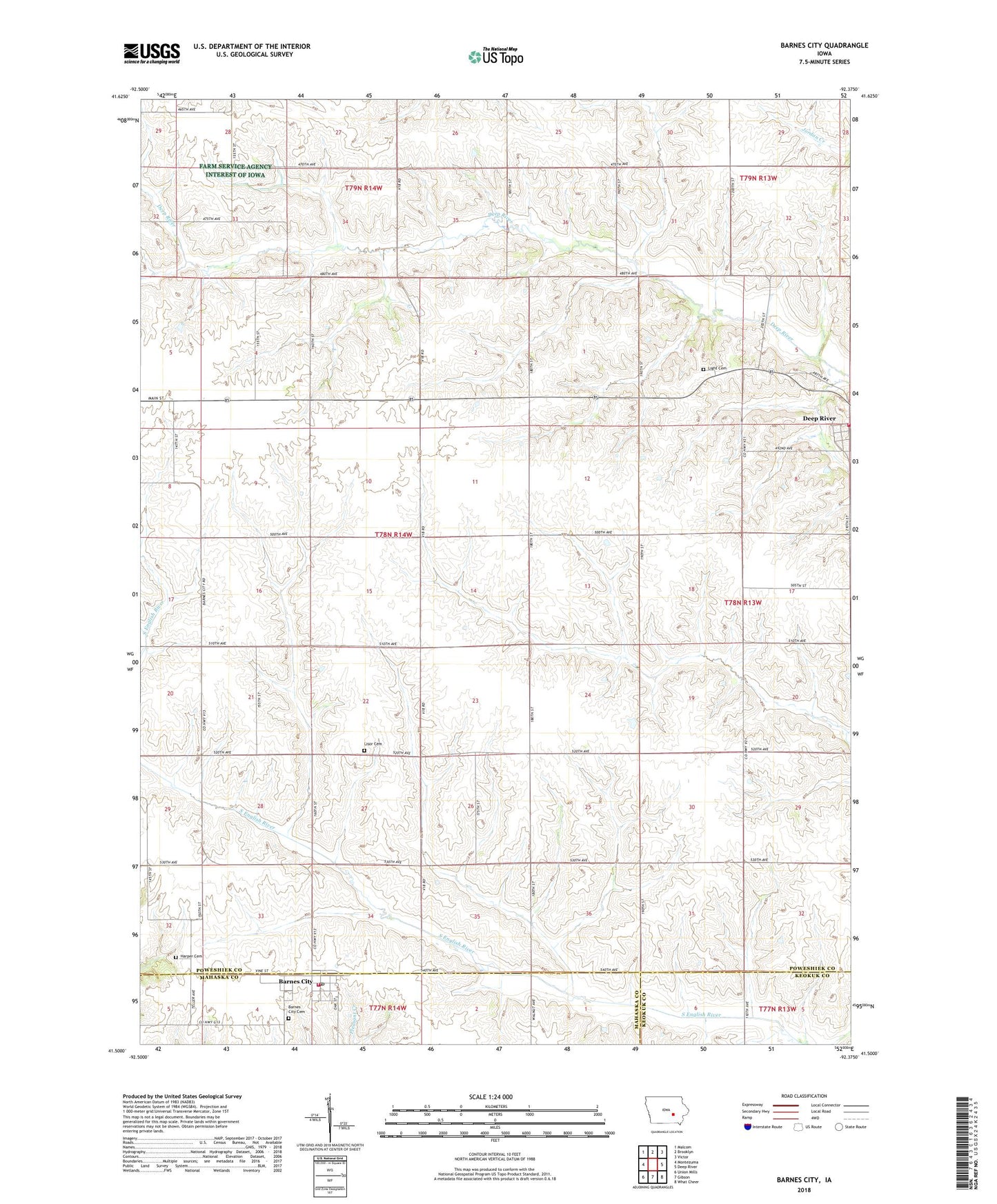
2022 topographic map quadrangle Barnes City in the state of Iowa. Scale: 1:24000. Based on the newly updated USGS 7.5' US Topo map series, this map is in the following counties: Poweshiek, Mahaska, Keokuk. The map contains contour data, water features, and other items you are used to seeing on USGS maps, but also has updated roads and other features. This is the next generation of topographic maps. Printed on high-quality waterproof paper with UV fade-resistant inks.
Quads adjacent to this one:
West: Montezuma
Northwest: Malcom
North: Brooklyn
Northeast: Victor
East: Deep River
Southeast: What Cheer
South: Gibson
Southwest: Union Mills
This map covers the same area as the classic USGS quad with code o41092e4.
Contains the following named places: Barnes, Barnes City, Barnes City Cemetery, Barnes City Community Church, Barnes City Fire Department, Barnes City Hall, Barnes City Post Office, Barnes City United Methodist Church, Boswell - Harper Pioneer Cemetery, Christian Church, City of Barnes City, Deep River, Deep River Volunteer Fire Department, East Field, Light Cemetery, Lisor - Beulah Cemetery, Tilton Post Office, Township of Jackson