MyTopo
Brooklyn Iowa US Topo Map
Couldn't load pickup availability
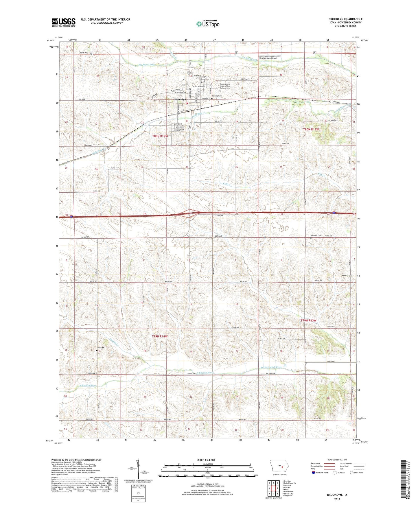
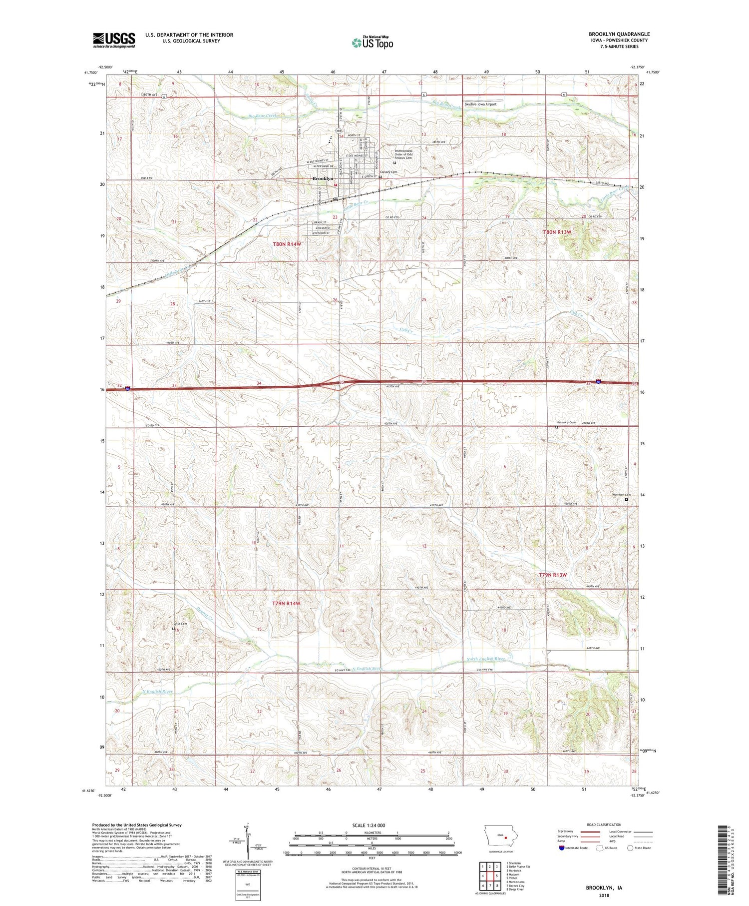
2022 topographic map quadrangle Brooklyn in the state of Iowa. Scale: 1:24000. Based on the newly updated USGS 7.5' US Topo map series, this map is in the following counties: Poweshiek. The map contains contour data, water features, and other items you are used to seeing on USGS maps, but also has updated roads and other features. This is the next generation of topographic maps. Printed on high-quality waterproof paper with UV fade-resistant inks.
Quads adjacent to this one:
West: Malcom
Northwest: Sheridan
North: Belle Plaine SW
Northeast: Hartwick
East: Victor
Southeast: Deep River
South: Barnes City
Southwest: Montezuma
This map covers the same area as the classic USGS quad with code o41092f4.
Contains the following named places: Brookhaven Nursing Home, Brooklyn, Brooklyn - Guernsey - Malcom Community School, Brooklyn - Guernsey - Malcom Junior / Senior High School, Brooklyn Elevator Incorporated Elevator, Brooklyn Fire Department, Brooklyn Library, Brooklyn Medical Clinic, Brooklyn Memorial Cemetery, Brooklyn Post Office, Brooklyn-Victor Country Club, Calvary Cemetery, City of Brooklyn, Dugout Creek, East Brooklyn Post Office, East Poweshiek Ambulance Service, East Poweshiek Ambulance Service Training Center, Harmony Cemetery, KSKB-FM (Brooklyn), Lone Pine Mobile Home Court, Lytle Cemetery, Methodist Church, Morrison Cemetery, Presbyterian Church, Saint Patrick Church, Skydive Iowa Airport, Stony Creek, Township of Bear Creek, Township of Scott