MyTopo
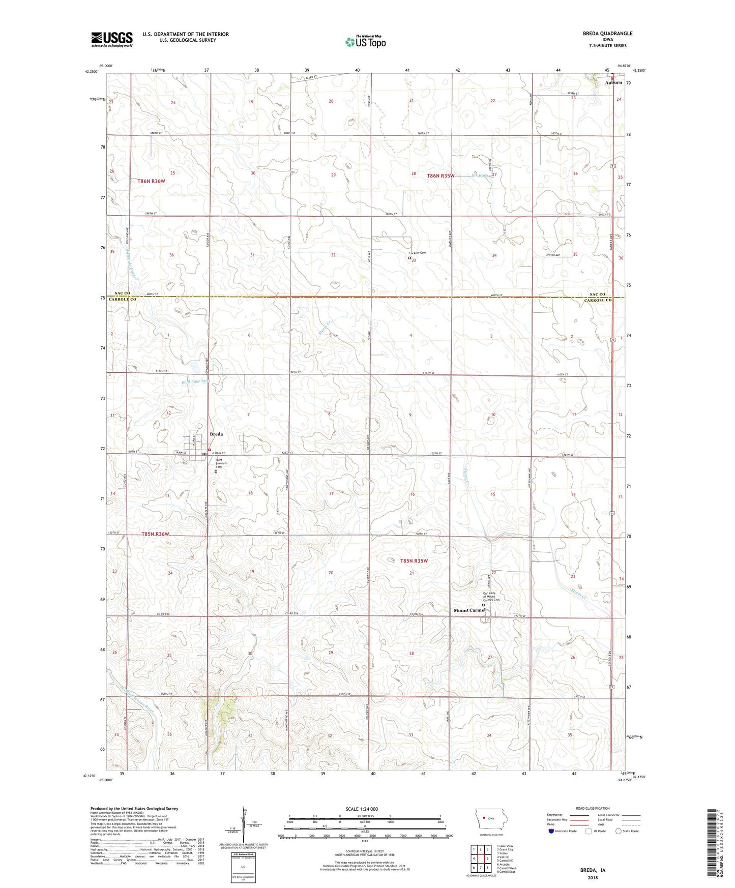
Breda Iowa US Topo Map
Couldn't load pickup availability
2022 topographic map quadrangle Breda in the state of Iowa. Scale: 1:24000. Based on the newly updated USGS 7.5' US Topo map series, this map is in the following counties: Carroll, Sac. The map contains contour data, water features, and other items you are used to seeing on USGS maps, but also has updated roads and other features. This is the next generation of topographic maps. Printed on high-quality waterproof paper with UV fade-resistant inks.
Quads adjacent to this one:
West: Vail NE
Northwest: Lake View
North: Grant City
Northeast: Yetter
East: Carroll NE
Southeast: Carroll East
South: Carroll West
Southwest: Arcadia
This map covers the same area as the classic USGS quad with code o42094b8.
Contains the following named places: Auburn Fire Department, Auburn Post Office, Breda, Breda City Hall, Breda Feed and Grain Incorporated Elevator, Breda Fire Department, Breda Golf Club, Breda Health Clinic, Breda Post Office, Carroll County Ambulance Service Breda, Christ the King School/Saint Bernard Center, City of Auburn, City of Breda, Drainage Ditch Number 57, Hazel Brush Wildlife Area, Luckow Cemetery, Mount Carmel, Mount Carmel Post Office, Our Lady of Mount Carmel Cemetery, Our Lady of Mount Carmel Church, Our Lady of Mount Carmel School, Saint Bernard Grade School, Saint Bernard High School, Saint Bernards Cemetery, Saint Bernard's Church, Sauk Rail Trail, Township of Kniest