MyTopo
Carroll East Iowa US Topo Map
Couldn't load pickup availability
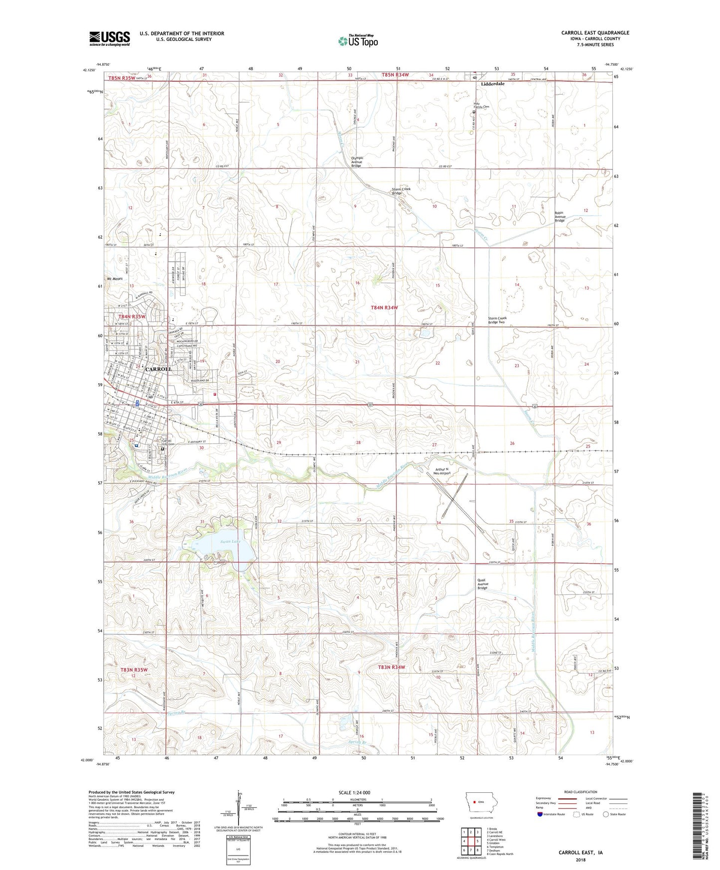
2022 topographic map quadrangle Carroll East in the state of Iowa. Scale: 1:24000. Based on the newly updated USGS 7.5' US Topo map series, this map is in the following counties: Carroll. The map contains contour data, water features, and other items you are used to seeing on USGS maps, but also has updated roads and other features. This is the next generation of topographic maps. Printed on high-quality waterproof paper with UV fade-resistant inks.
Quads adjacent to this one:
West: Carroll West
Northwest: Breda
North: Carroll NE
Northeast: Lanesboro
East: Glidden
Southeast: Coon Rapids North
South: Dedham
Southwest: Templeton
This map covers the same area as the classic USGS quad with code o42094a7.
Contains the following named places: Adams Elementary School, Arthur N Neu Airport, Carroll, Carroll Alternative School, Carroll Baptist Church, Carroll City Cemetery, Carroll City Hall, Carroll City Public Library, Carroll City Wastewater Plant, Carroll Country Club, Carroll County, Carroll County Ambulance Service, Carroll County Courthouse, Carroll County Historical Museum, Carroll County Home, Carroll County Sheriff's Office, Carroll Dental Clinic, Carroll Eye Care Associates Center, Carroll Eye Clinic, Carroll Fire Department, Carroll Health Center, Carroll High School, Carroll Little League Complex, Carroll Manor, Carroll Middle School, Carroll Municipal Golf Course, Carroll Police Department, Carroll Post Office, Carroll Water Treatment Plant, Central Christian Church, Child Health Specialty Clinics, Church of Christ, City of Carroll, City of Lidderdale, Dental Associates Center, Des Moines Area Community College - Carroll Campus, Fairview Elementary School, Faith Baptist Church, Family and Specialty Medical Center, Family Care Physicians Center, Farmers Co-op Elevator, First Presbyterian Church, First United Methodist Church, Grace Christian Fellowship, Graham Park, Grant Number 5 School, Hazelton Wildlife Area, Holy Family Catholic Church, Holy Family Cemetery, Holy Spirit Catholic Church, Holy Spirit Elementary School, Immanuel Lutheran Church, Iowa Eye Institute, Iowa Heart Center, Iowa Orthopedic Group Center, Iowa Physicians Center, Iowa Radiology Consultants Center, Kuemper Catholic High School, Kuemper Catholic Middle School / Saint Lawrence Center, Kuemper Catholic School / Saint Angela Center, Lidderdale, Lidderdale City Hall, Lidderdale Fire Department First Responders, Lidderdale Post Office, Macks Post Office, McFarland Clinic, Midwest Urology Associates Center, Minchen Park, Mount Moses, North Park, Northeast Park, Olympic Avenue Bridge, Quail Avenue Bridge, Robin Avenue Bridge, Rolling Hills Park, Saint Anthony Nursing Home, Saint Anthony Regional Hospital, Saint Anthony Regional Hospital Heliport, Saint John Evangelical Lutheran Church, Saint Johns Church, Saint Lawrence Catholic Church, South Side Park, Storm Creek, Storm Creek Bridge, Storm Creek Bridge Two, Surgical Consultants Center, Swan Lake, Swan Lake Farmstead Museum, Swan Lake State Park, Township of Grant, Trinity Episcopal Church, Turbine Fuel Technologies First Responders, Veterans Memorial Park, ZIP Code: 51401