MyTopo
Cairo Iowa US Topo Map
Couldn't load pickup availability
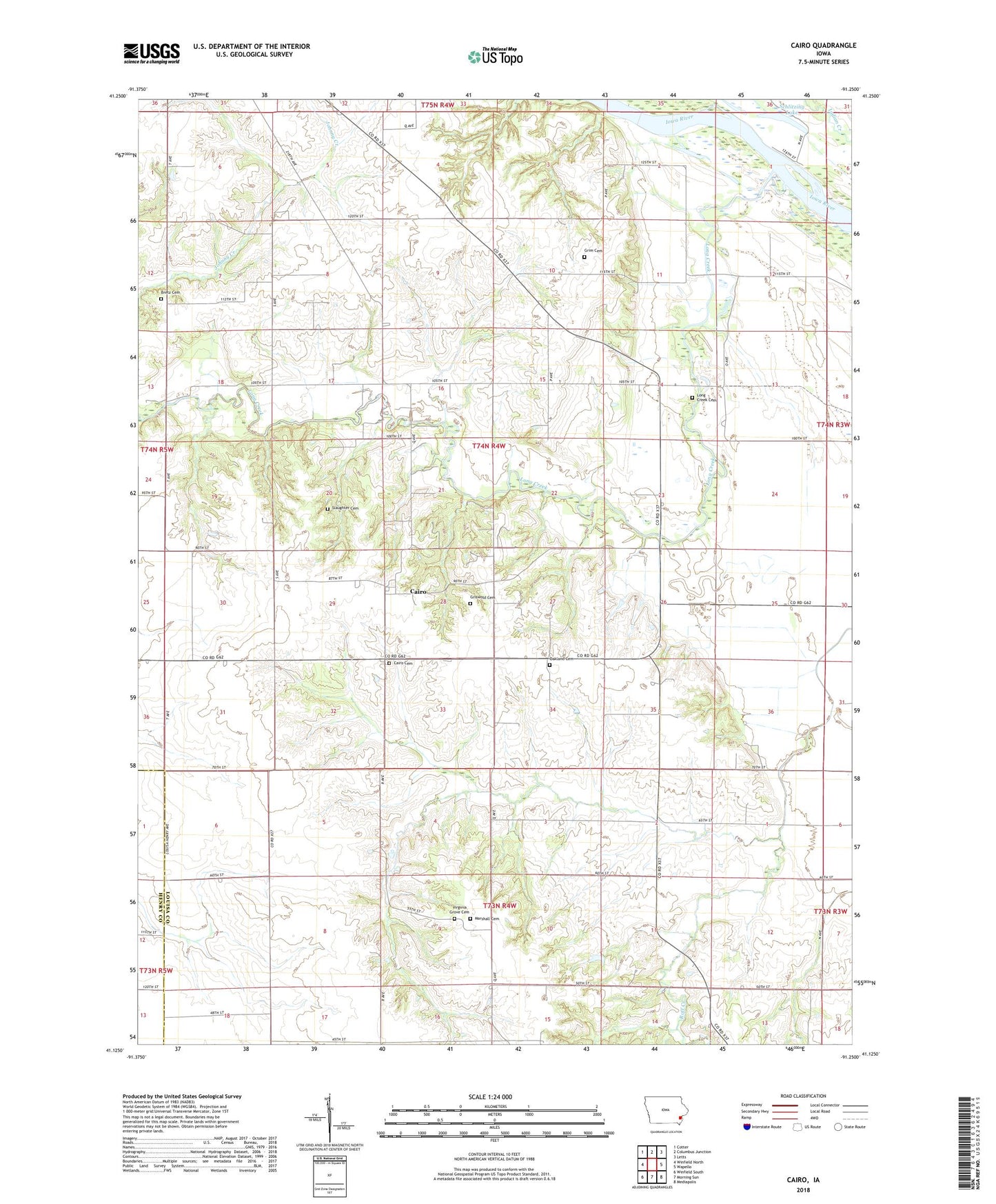
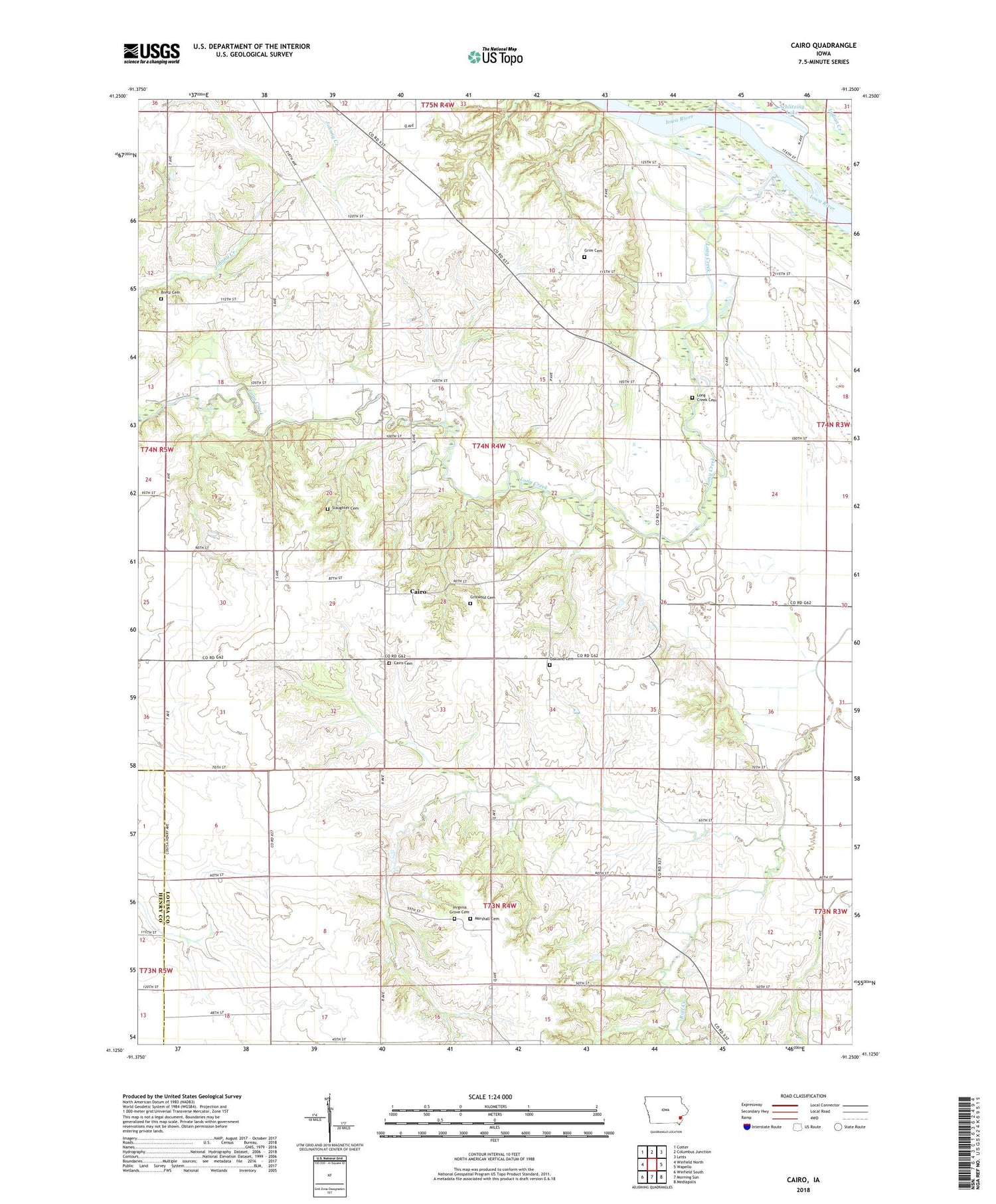
2022 topographic map quadrangle Cairo in the state of Iowa. Scale: 1:24000. Based on the newly updated USGS 7.5' US Topo map series, this map is in the following counties: Louisa, Henry. The map contains contour data, water features, and other items you are used to seeing on USGS maps, but also has updated roads and other features. This is the next generation of topographic maps. Printed on high-quality waterproof paper with UV fade-resistant inks.
Quads adjacent to this one:
West: Winfield North
Northwest: Cotter
North: Columbus Junction
Northeast: Letts
East: Wapello
Southeast: Mediapolis
South: Morning Sun
Southwest: Winfield South
This map covers the same area as the classic USGS quad with code o41091b3.
Contains the following named places: Bard, Bard Post Office, Bretz Cemetery, Cairo, Cairo Cemetery, Cairo Gas Storage Field, Cairo Post Office, Cairo Woods Wildlife Area, Grim Cemetery, Griswold Cemetery, Long Creek, Long Creek Cemetery, Louisa Center Church, Louisa Centre Post Office, Louisa County, Marshall Cemetery, Oakland Cemetery, Oakland Church, Otter Creek Community Center, Port Paradise Farms Airport, Roff Creek, Schlitzing Lake, Slaughter Cemetery, Spring Run Post Office, Township of Marshall, Virginia Grove Cemetery, Virginia Grove Park, Virginia Grove Post Office