MyTopo
Cotter Iowa US Topo Map
Couldn't load pickup availability
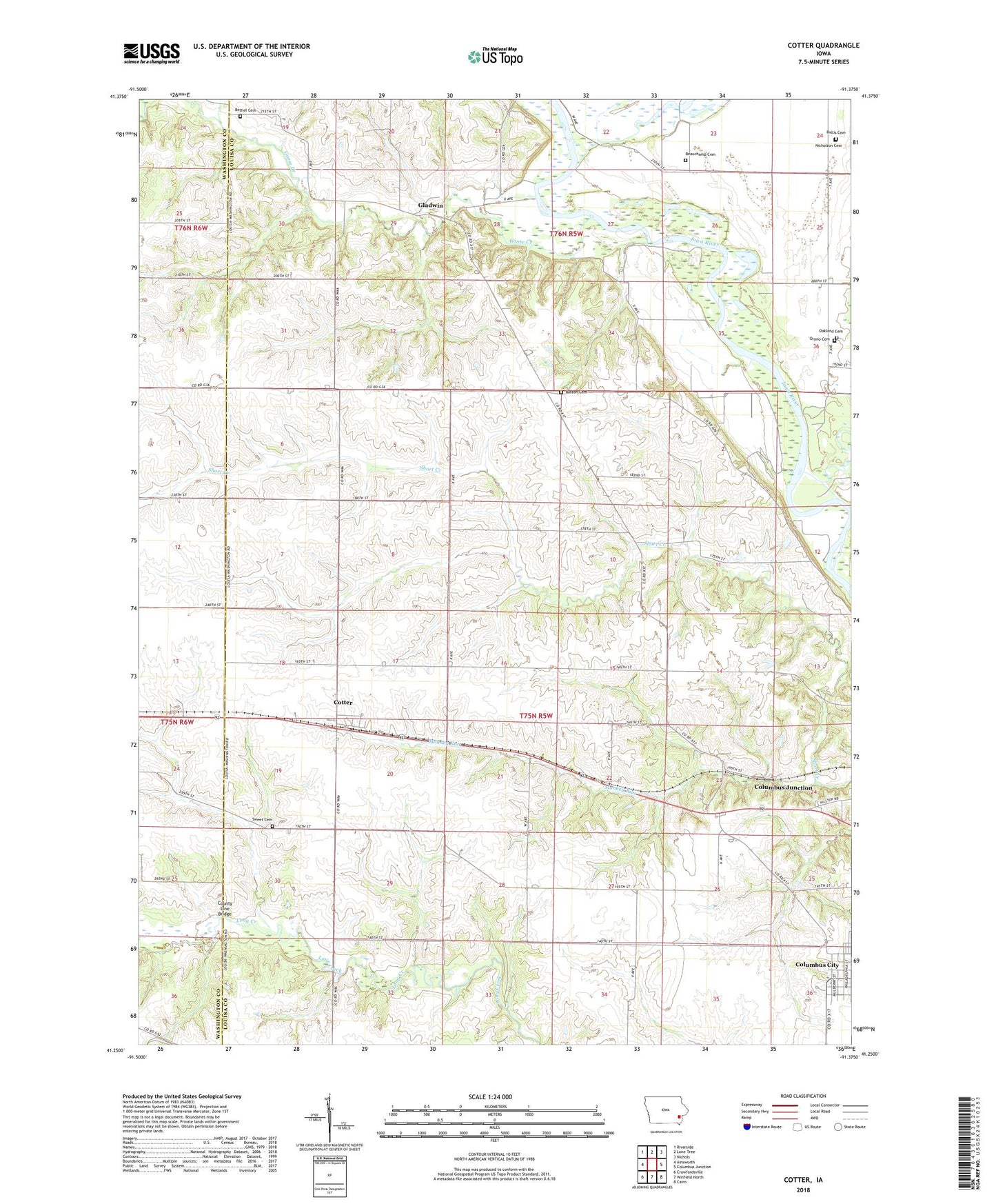
2022 topographic map quadrangle Cotter in the state of Iowa. Scale: 1:24000. Based on the newly updated USGS 7.5' US Topo map series, this map is in the following counties: Louisa, Washington. The map contains contour data, water features, and other items you are used to seeing on USGS maps, but also has updated roads and other features. This is the next generation of topographic maps. Printed on high-quality waterproof paper with UV fade-resistant inks.
Quads adjacent to this one:
West: Ainsworth
Northwest: Riverside
North: Lone Tree
Northeast: Nichols
East: Columbus Junction
Southeast: Cairo
South: Winfield North
Southwest: Crawfordsville
This map covers the same area as the classic USGS quad with code o41091c4.
Contains the following named places: Beauchamp Cemetery, Bethel, Bethel Cemetery, Bethel Post Office, Boston Cemetery, Bullis Cemetery, Cedarcrest Country Club, City of Cotter, Clifton, Columbus City Cemetery, Columbus Junction Gas Storage Area, Cotter, Cotter Church, Cotter Elementary School, Cotter Post Office, County Line Bridge, Gladwin, Gladwin Post Office, Goose Creek, Honey Creek, Monkey Run, Nicholson Cemetery, Oakland Cemetery, Orono Cemetery, Port Allen, Sweet Cemetery, Township of Columbus City, Township of Union, Twin Oak, Twin Oak Post Office, ZIP Code: 52738