MyTopo
Carpenter Iowa US Topo Map
Couldn't load pickup availability
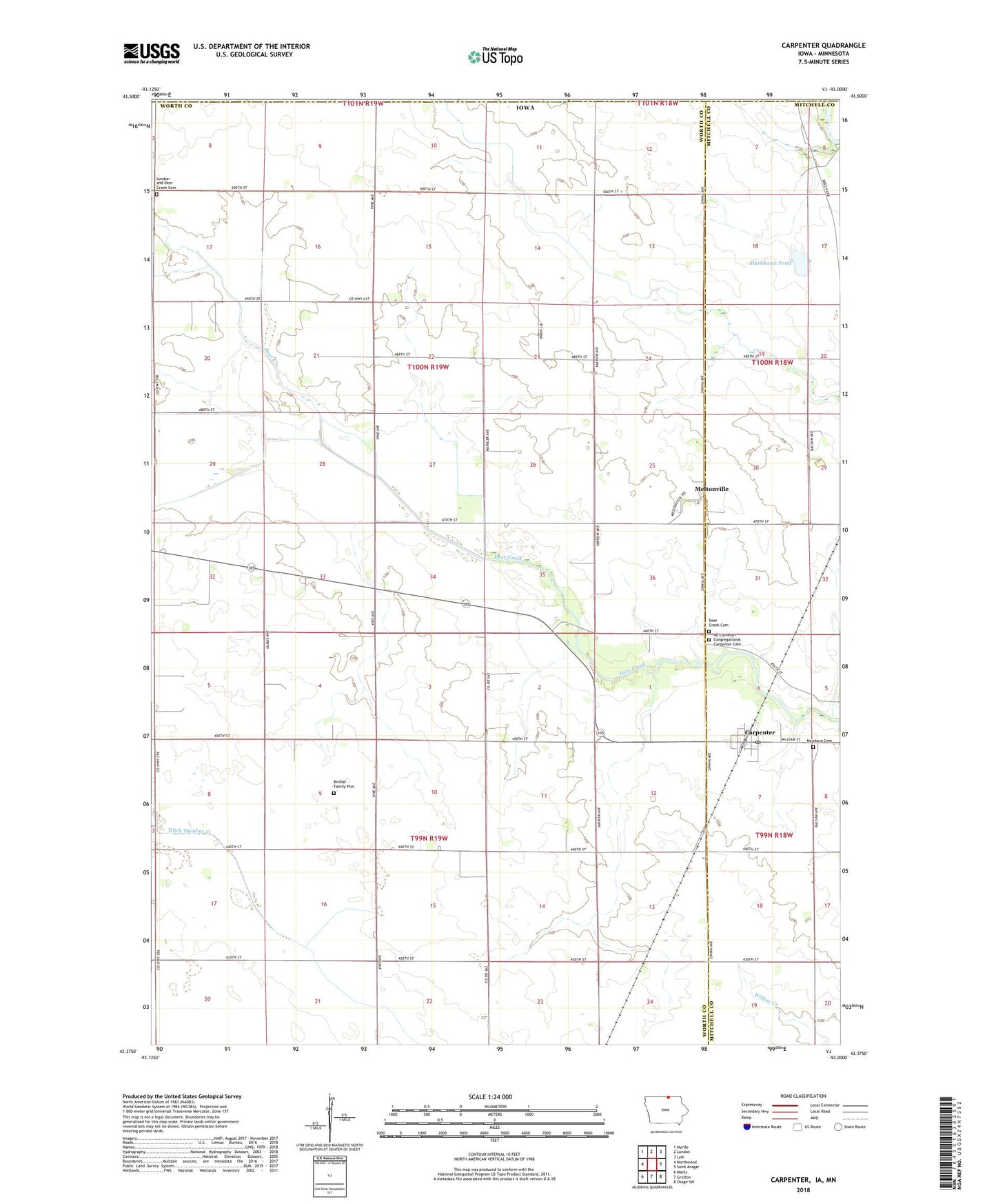
2022 topographic map quadrangle Carpenter in the state of Iowa. Scale: 1:24000. Based on the newly updated USGS 7.5' US Topo map series, this map is in the following counties: Worth, Mitchell, Freeborn, Mower. The map contains contour data, water features, and other items you are used to seeing on USGS maps, but also has updated roads and other features. This is the next generation of topographic maps. Printed on high-quality waterproof paper with UV fade-resistant inks.
Quads adjacent to this one:
West: Northwood
Northwest: Myrtle
North: London
Northeast: Lyle
East: Saint Ansgar
Southeast: Osage SW
South: Grafton
Southwest: Manly
Contains the following named places: Birdsal Family Plot, Carpenter, Carpenter Post Office, City of Carpenter, Deer Creek Church, Deer Creek Forest, Deer Creek Lutheran Church Cemetery, Deer Creek Rest Area, Deer Creek Wildlife Area, London and Deer Creek Cemetery, Markhams Pond, Meltonville, Meltonville Post Office, NE Lutheran Congregational Carpenter Cemetery, Newburg Cemetery, Northwood Co-op Elevator, Otranto, Otranto Post Office, Township of Barton, Township of Deer Creek, ZIP Code: 50426