MyTopo
Manly Iowa US Topo Map
Couldn't load pickup availability
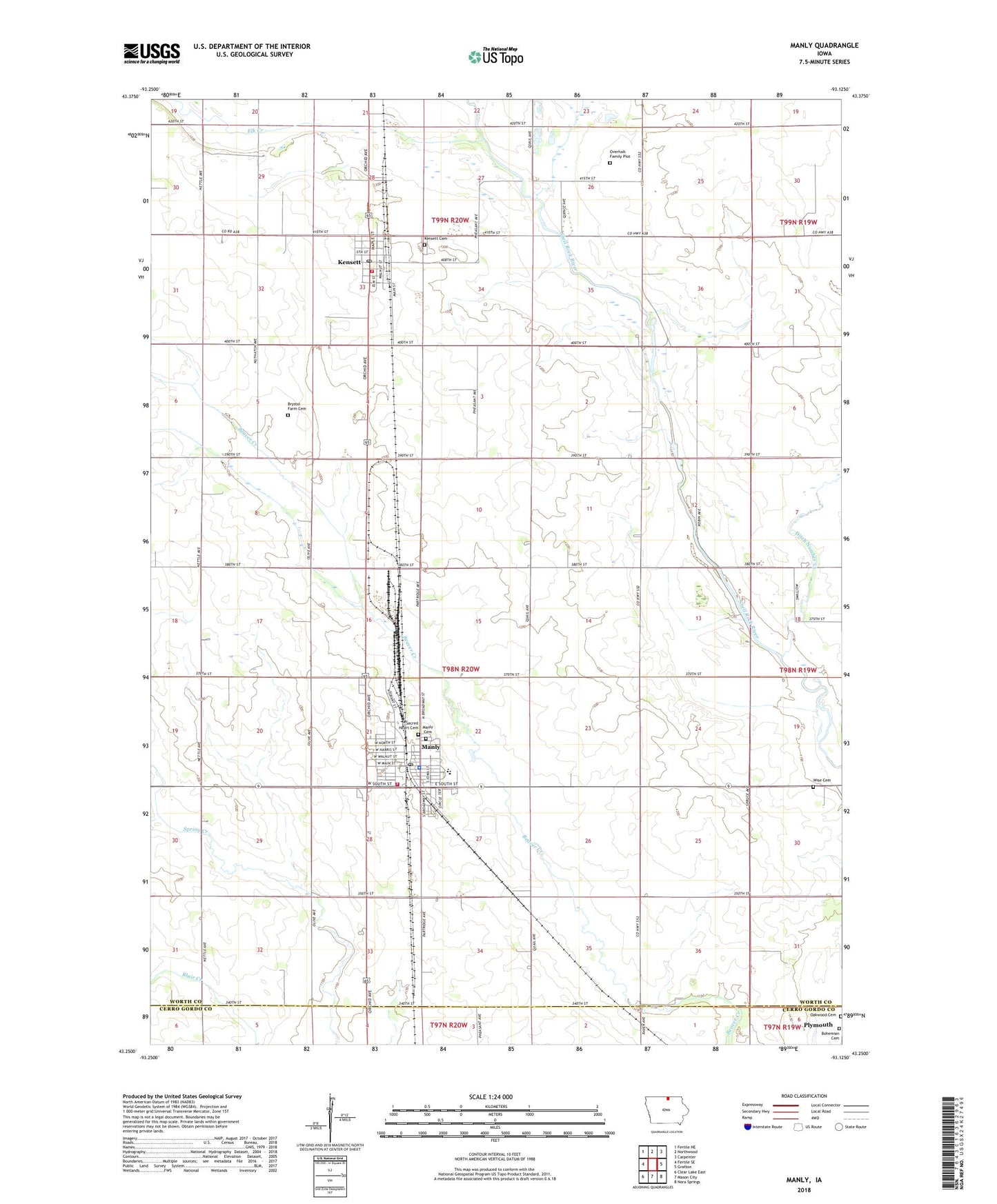
2022 topographic map quadrangle Manly in the state of Iowa. Scale: 1:24000. Based on the newly updated USGS 7.5' US Topo map series, this map is in the following counties: Worth, Cerro Gordo. The map contains contour data, water features, and other items you are used to seeing on USGS maps, but also has updated roads and other features. This is the next generation of topographic maps. Printed on high-quality waterproof paper with UV fade-resistant inks.
Quads adjacent to this one:
West: Fertile SE
Northwest: Fertile NE
North: Northwood
Northeast: Carpenter
East: Grafton
Southeast: Nora Springs
South: Mason City
Southwest: Clear Lake East
This map covers the same area as the classic USGS quad with code o43093c2.
Contains the following named places: Bethel United Methodist Church, Bethlehem Lutheran Church, Bliar Creek Area, Bohemian Cemetery, Brystol Farm Cemetery, Central Springs Elementary School, Central Springs High School, City of Kensett, City of Manly, Ditch Number 53, Elk Creek, Farmers Co-op Elevator, Glade, Glade Post Office, Kensett, Kensett Cemetery, Kensett Post Office, Kensett Volunteer Fire Department, Kinsett, Land of Two Waters, Manly, Manly Caboose Museum, Manly Cemetery, Manly City Hall, Manly Nursing and Rehabilitation Center, Manly Police Department, Manly Post Office, Manly Public Library, Manly Volunteer Fire Department, Oakwood Cemetery, Overholt Family Plot, Pioneer Town and Country Club, Sacred Heart Catholic Church, Sacred Heart Cemetery, Tostenson Wildlife Area, Township of Lincoln, Westfield Post Office, Wise Cemetery, Worth County Lake Park, ZIP Codes: 50448, 50456