MyTopo
Coon Rapids South Iowa US Topo Map
Couldn't load pickup availability
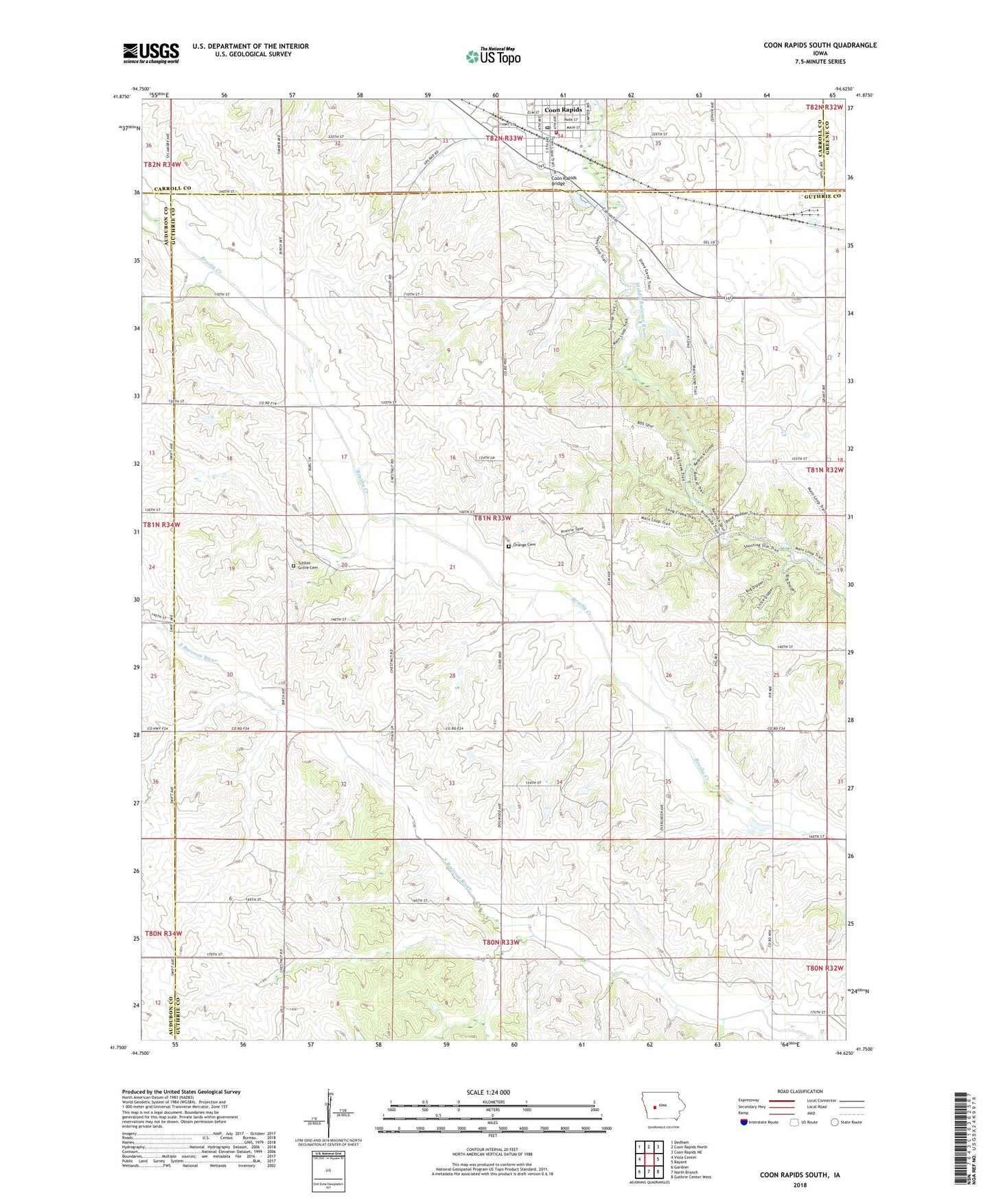
2022 topographic map quadrangle Coon Rapids South in the state of Iowa. Scale: 1:24000. Based on the newly updated USGS 7.5' US Topo map series, this map is in the following counties: Guthrie, Carroll, Audubon, Greene. The map contains contour data, water features, and other items you are used to seeing on USGS maps, but also has updated roads and other features. This is the next generation of topographic maps. Printed on high-quality waterproof paper with UV fade-resistant inks.
Quads adjacent to this one:
West: Viola Center
Northwest: Dedham
North: Coon Rapids North
Northeast: Coon Rapids NE
East: Bayard
Southeast: Guthrie Center West
South: North Branch
Southwest: Gardner
This map covers the same area as the classic USGS quad with code o41094g6.
Contains the following named places: Ascension Lutheran Church, Brushy Valley Post Office, Christy Pond Park, City of Coon Rapids, Coon Rapids, Coon Rapids Bridge, Coon Rapids Post Office, CR Family Dentistry Center, Elk Grove Wildlife Management Area, Erastus Post Office, Eratus, Farmers Cooperative Company Elevator, First Christian Church, Orange Cemetery, Orange Grove Post Office, Saint Anthony Village Clinic, Thomas Rest Haven, Township of Orange, Tuttle Grove, Tuttle Grove Post Office, Tuttles Grove Cemetery, ZIP Code: 50058