MyTopo
North Branch Iowa US Topo Map
Couldn't load pickup availability
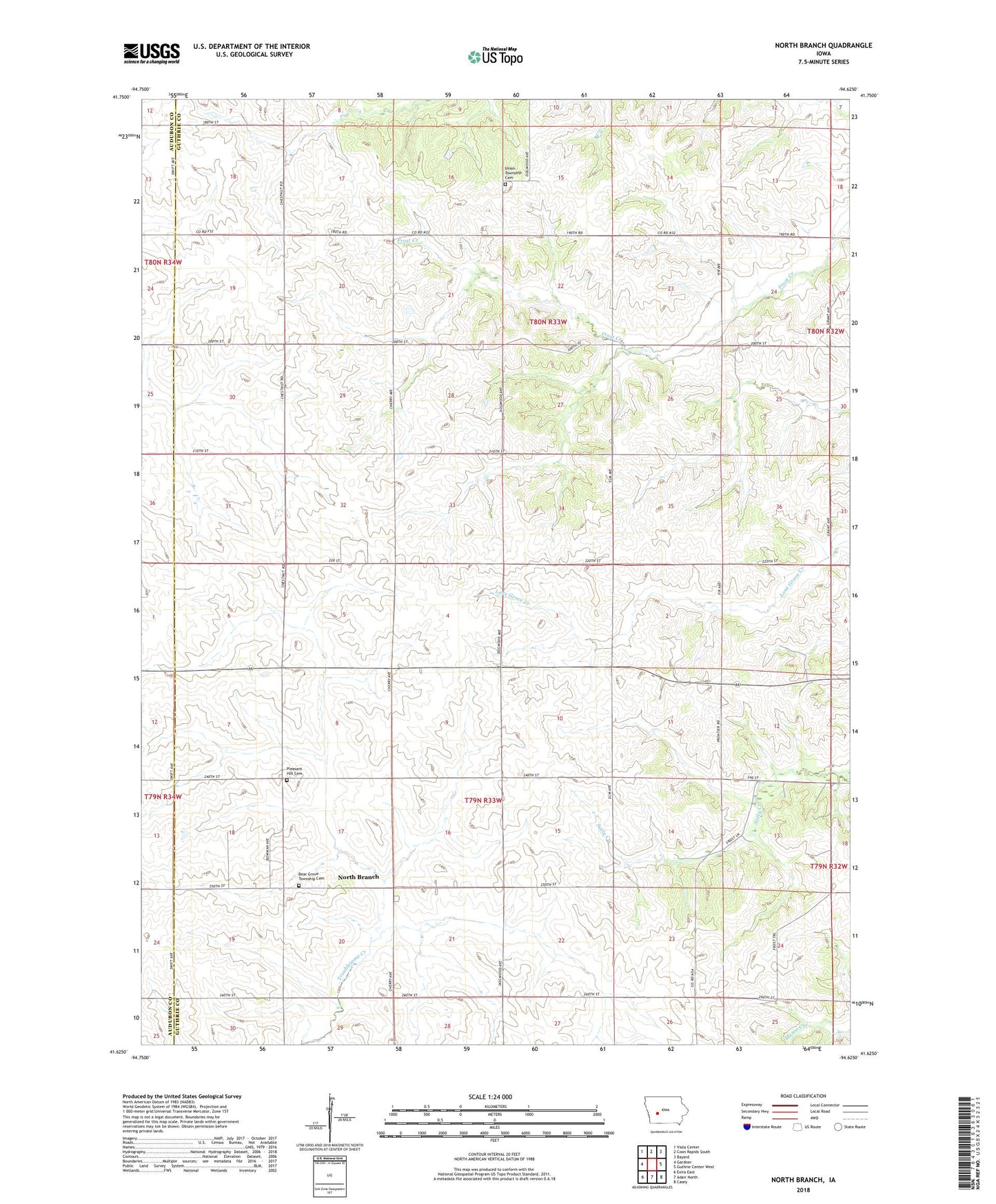
2022 topographic map quadrangle North Branch in the state of Iowa. Scale: 1:24000. Based on the newly updated USGS 7.5' US Topo map series, this map is in the following counties: Guthrie, Audubon. The map contains contour data, water features, and other items you are used to seeing on USGS maps, but also has updated roads and other features. This is the next generation of topographic maps. Printed on high-quality waterproof paper with UV fade-resistant inks.
Quads adjacent to this one:
West: Gardner
Northwest: Viola Center
North: Coon Rapids South
Northeast: Bayard
East: Guthrie Center West
Southeast: Casey
South: Adair North
Southwest: Exira East
This map covers the same area as the classic USGS quad with code o41094f6.
Contains the following named places: Bear Grove, Bear Grove Township Cemetery, Beargrove Post Office, Bowman Chapel, Graceville Post Office, Harrison Post Office, Lone Star Church, Nelson, Nelson Post Office, North Branch, North Branch Post Office, Pleasant Hill Cemetery, Sutcliff Woodland, Township of Bear Grove, Township of Union, Union Township Cemetery, Van Meter Feedyard