MyTopo
Correctionville NW Iowa US Topo Map
Couldn't load pickup availability
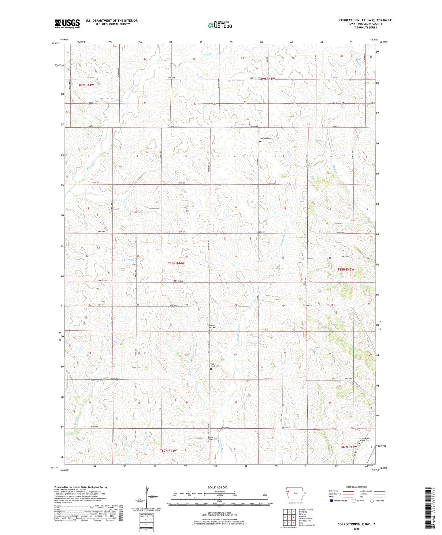
2022 topographic map quadrangle Correctionville NW in the state of Iowa. Scale: 1:24000. Based on the newly updated USGS 7.5' US Topo map series, this map is in the following counties: Woodbury. The map contains contour data, water features, and other items you are used to seeing on USGS maps, but also has updated roads and other features. This is the next generation of topographic maps. Printed on high-quality waterproof paper with UV fade-resistant inks.
Quads adjacent to this one:
West: Moville
Northwest: Union Center SE
North: Kingsley
Northeast: Pierson
East: Correctionville
Southeast: Correctionville SE
South: Oto
Southwest: Climbing Hill
This map covers the same area as the classic USGS quad with code o42095d8.
Contains the following named places: Fairfield Cemetery, Gale, Kuhn Farms, Lucky Valley, Lucky Valley Cemetery, Luckyvalley Post Office, Mount Saint Joseph Cemetery, Pleasant Hill Cemetery, Rock Branch, Rock Branch Church, Rockbranch Post Office, Township of Wolf Creek, Wolf Creek Cemetery, Wolf Dale, Wolfdale Post Office