MyTopo
Pierson Iowa US Topo Map
Couldn't load pickup availability
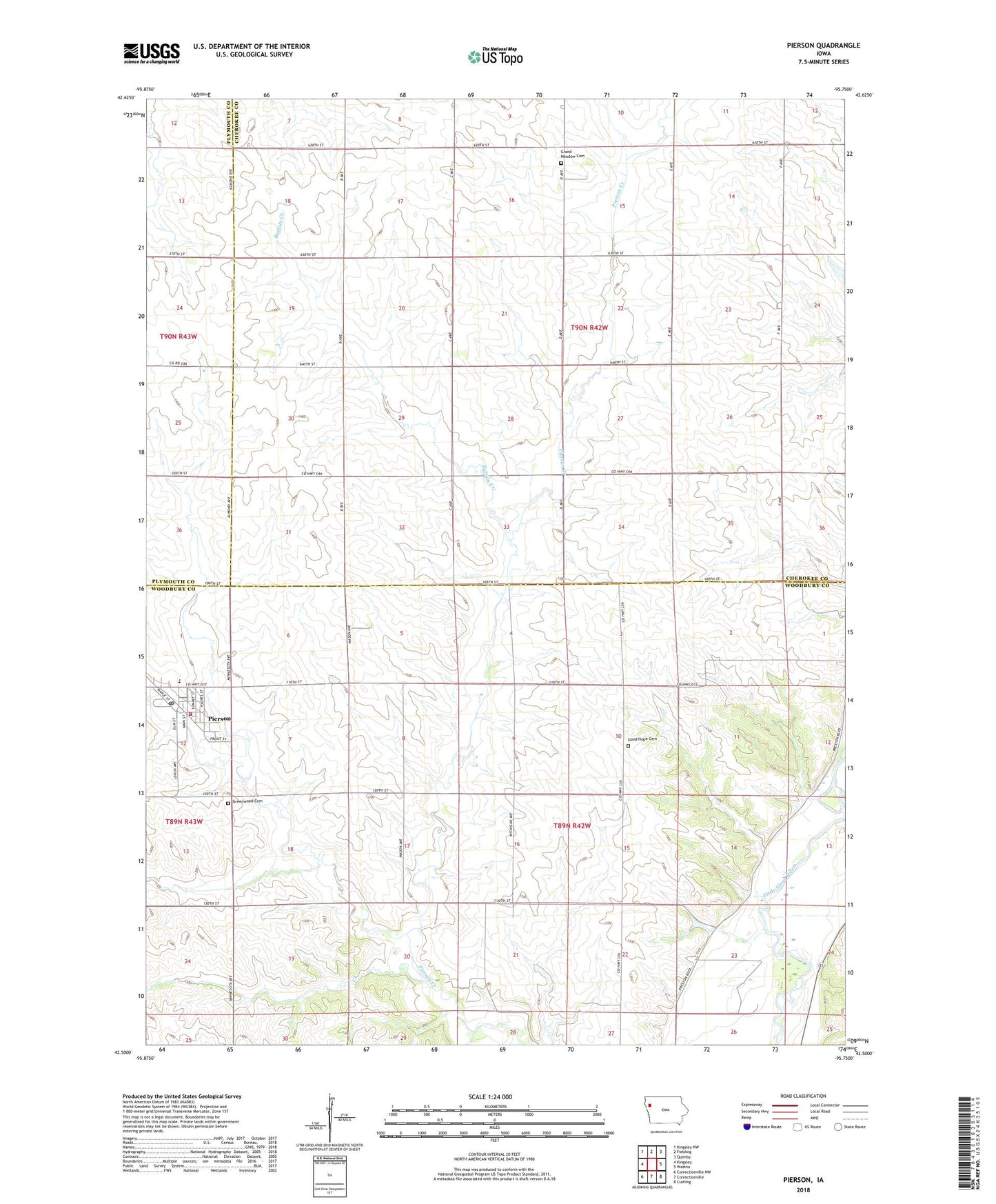
2022 topographic map quadrangle Pierson in the state of Iowa. Scale: 1:24000. Based on the newly updated USGS 7.5' US Topo map series, this map is in the following counties: Woodbury, Cherokee, Plymouth. The map contains contour data, water features, and other items you are used to seeing on USGS maps, but also has updated roads and other features. This is the next generation of topographic maps. Printed on high-quality waterproof paper with UV fade-resistant inks.
Quads adjacent to this one:
West: Kingsley
Northwest: Kingsley NW
North: Fielding
Northeast: Quimby
East: Washta
Southeast: Cushing
South: Correctionville
Southwest: Correctionville NW
This map covers the same area as the classic USGS quad with code o42095e7.
Contains the following named places: Buffalo Creek, Christian Church, City of Pierson, D F B Farms, Good Hope Cemetery, Grand Meadow Cemetery, Grand Meadow School, Greenwood Cemetery, Kingsley - Pierson Middle School, Meadow Star Church, Pierson, Pierson City Hall, Pierson Fire Department, Pierson Library, Pierson Post Office, Pierson United Methodist Church, Three D Farm, Township of Grand Meadow, Township of Union, Trapp Farms, ZIP Code: 51048