MyTopo
Durant Iowa US Topo Map
Couldn't load pickup availability
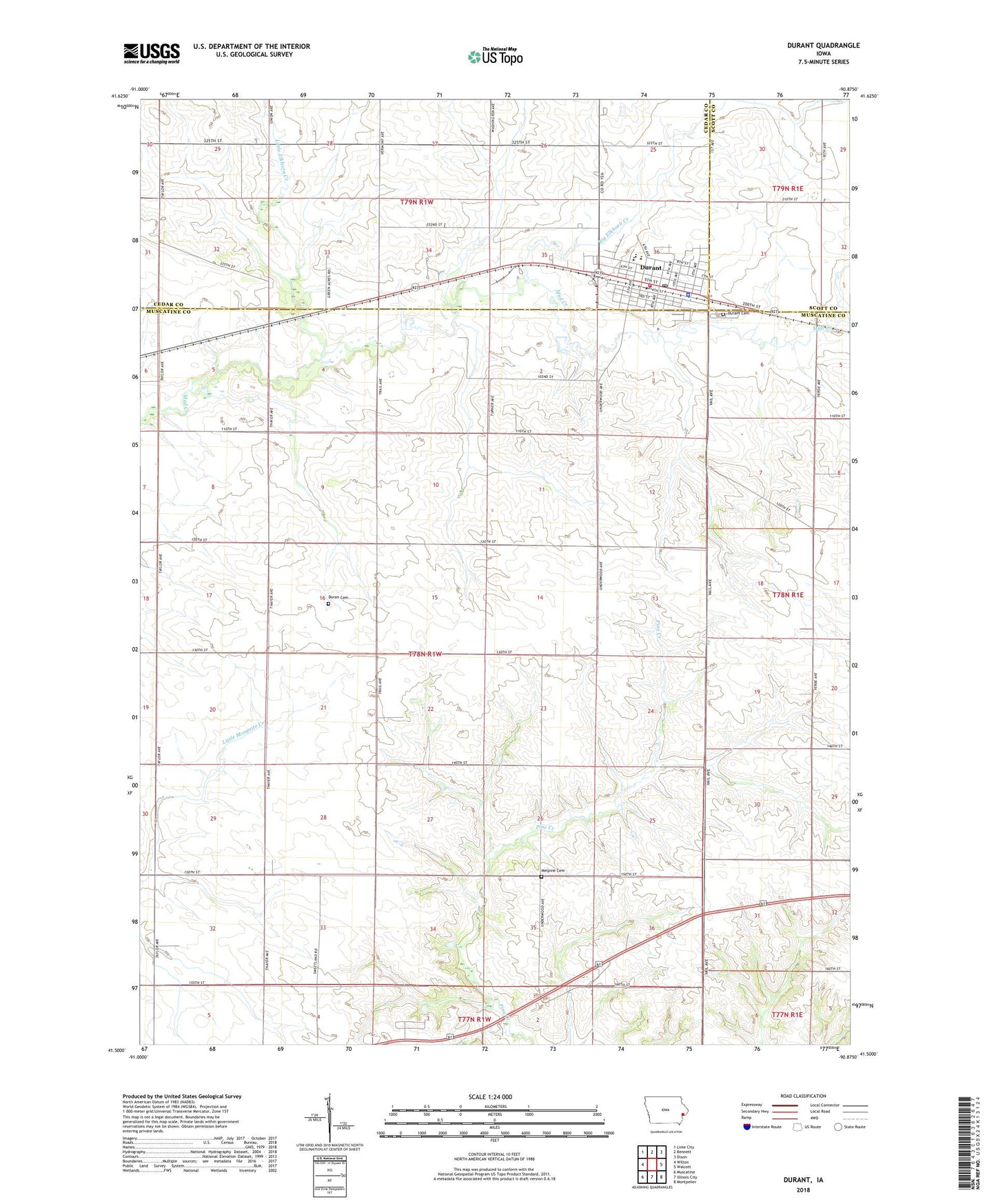
2022 topographic map quadrangle Durant in the state of Iowa. Scale: 1:24000. Based on the newly updated USGS 7.5' US Topo map series, this map is in the following counties: Muscatine, Cedar, Scott. The map contains contour data, water features, and other items you are used to seeing on USGS maps, but also has updated roads and other features. This is the next generation of topographic maps. Printed on high-quality waterproof paper with UV fade-resistant inks.
Quads adjacent to this one:
West: Wilton
Northwest: Lime City
North: Bennett
Northeast: Dixon
East: Walcott
Southeast: Montpelier
South: Illinois City
Southwest: Muscatine
This map covers the same area as the classic USGS quad with code o41090e8.
Contains the following named places: Big Elkhorn Creek, Center Grove School, City of Durant, Crab Apple School, Doran Cemetery, Durant, Durant Ambulance Service, Durant Cemetery, Durant City Hall, Durant City Library, Durant City Wastewater Plant, Durant Community Fire Department, Durant Community School, Durant High School, Durant Medical Center, Durant Middle School, Durant Police Department, Durant Post Office, Dutton Park, Gloria Dei Lutheran Church, KFMH-FM (Muscatine), Laurel Hill School, Little Elkhorn Creek, Melpine Cemetery, Melpine Post Office, Melpine School, Prairie School, Prospect Hill School, Saint Pauls Episcopal Church, Sunnyside School, Township of Wilton, Wahkonsa Country Club, ZIP Codes: 52747, 52778