MyTopo
Dixon Iowa US Topo Map
Couldn't load pickup availability
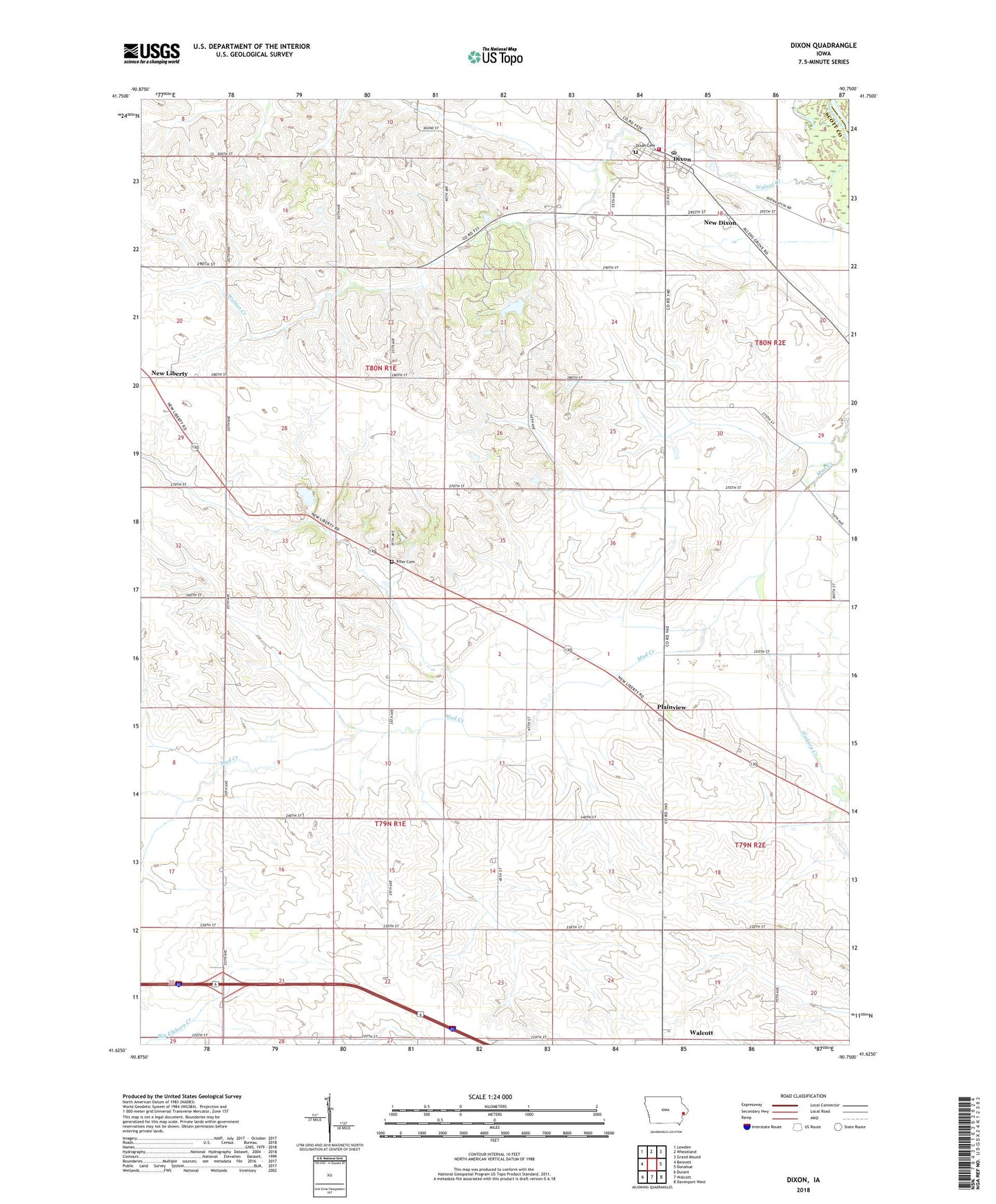
2022 topographic map quadrangle Dixon in the state of Iowa. Scale: 1:24000. Based on the newly updated USGS 7.5' US Topo map series, this map is in the following counties: Scott, Clinton. The map contains contour data, water features, and other items you are used to seeing on USGS maps, but also has updated roads and other features. This is the next generation of topographic maps. Printed on high-quality waterproof paper with UV fade-resistant inks.
Quads adjacent to this one:
West: Bennett
Northwest: Lowden
North: Wheatland
Northeast: Grand Mound
East: Donahue
Southeast: Davenport West
South: Walcott
Southwest: Durant
This map covers the same area as the classic USGS quad with code o41090f7.
Contains the following named places: City of Dixon, Conestoga Girl Scout Camp, Dixon, Dixon Cemetery, Dixon City Hall, Dixon Post Office, Dixon Volunteer Fire Department, Dreyir School, Fairview Independent School, Hickory Creek, Hope Church, Kizer Cemetery, Memorial Park, New Dixon, New Hamburgh Post Office, Plain View Post Office, Plainview, Plainview Census Designated Place, Round Grove, Round Grove Post Office, Round Grove School, Township of Cleona, Township of Liberty, ZIP Codes: 52745, 52765