MyTopo
Dyersville West Iowa US Topo Map
Couldn't load pickup availability
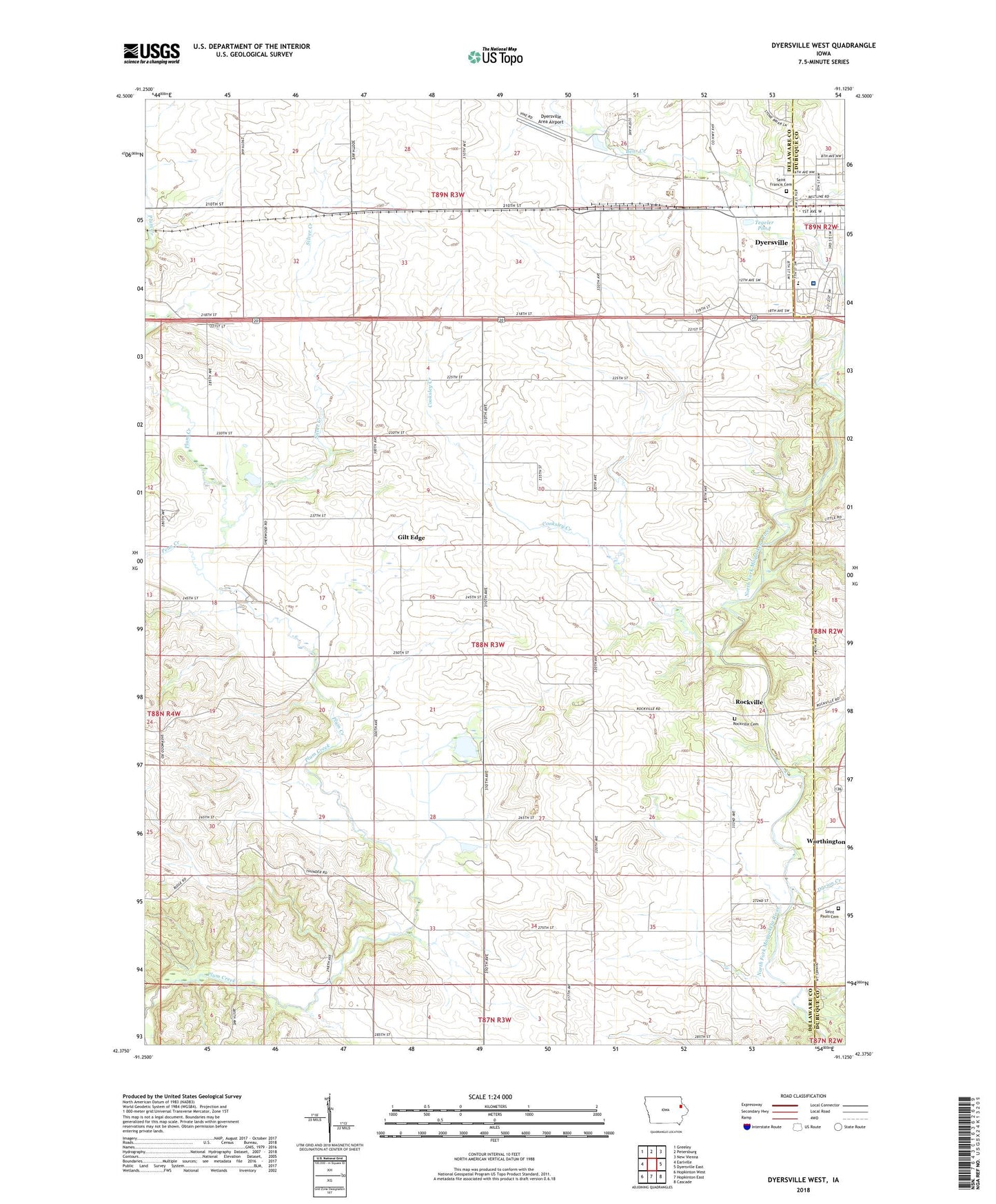
2022 topographic map quadrangle Dyersville West in the state of Iowa. Scale: 1:24000. Based on the newly updated USGS 7.5' US Topo map series, this map is in the following counties: Delaware, Dubuque. The map contains contour data, water features, and other items you are used to seeing on USGS maps, but also has updated roads and other features. This is the next generation of topographic maps. Printed on high-quality waterproof paper with UV fade-resistant inks.
Quads adjacent to this one:
West: Earlville
Northwest: Greeley
North: Petersburg
Northeast: New Vienna
East: Dyersville East
Southeast: Cascade
South: Hopkinton East
Southwest: Hopkinton West
This map covers the same area as the classic USGS quad with code o42091d2.
Contains the following named places: Bear Creek, Cooksley Creek, Durion Creek, Dyersville Area Airport, Dyersville Elementary School, Dyersville Family Practice Center, Gilt Edge, Giltedge Post Office, KDST-FM (Dyersville), Mercy Medical Center Dyersville, Northwind Mobile Home Park, Oakcrest Nursing Home, Penn Creek, Rockville, Rockville Cemetery, Rockville Post Office, Saint Francis Cemetery, Saint Francis Xavier Roman Catholic Basilica, Saint Francis Xavier School, Saint Paul Cemetery, Silver Creek, Tegeler Pond, Township of North Fork, Vanduesen Cemetery