MyTopo
Hopkinton East Iowa US Topo Map
Couldn't load pickup availability
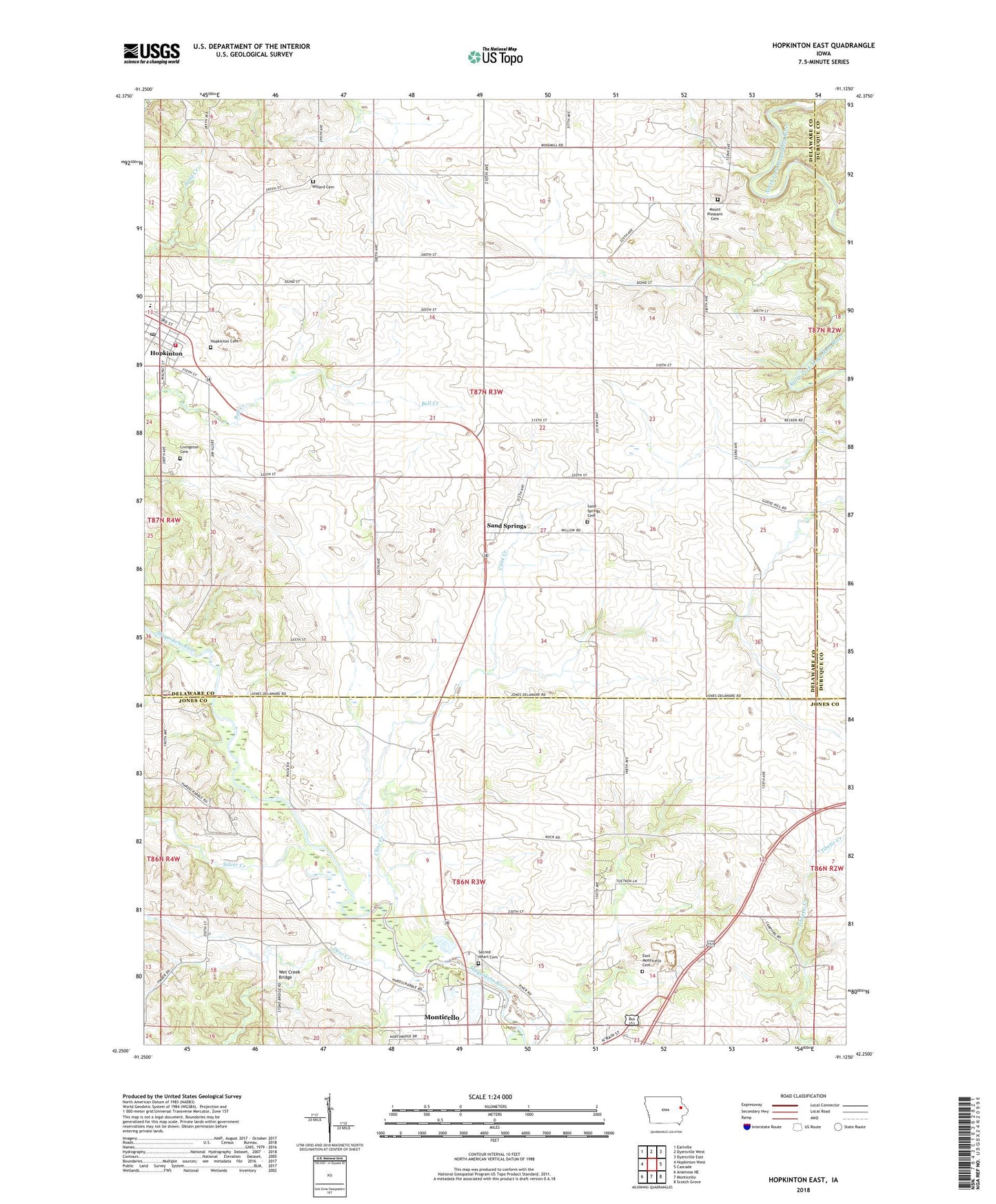
2022 topographic map quadrangle Hopkinton East in the state of Iowa. Scale: 1:24000. Based on the newly updated USGS 7.5' US Topo map series, this map is in the following counties: Delaware, Jones, Dubuque. The map contains contour data, water features, and other items you are used to seeing on USGS maps, but also has updated roads and other features. This is the next generation of topographic maps. Printed on high-quality waterproof paper with UV fade-resistant inks.
Quads adjacent to this one:
West: Hopkinton West
Northwest: Earlville
North: Dyersville West
Northeast: Dyersville East
East: Cascade
Southeast: Scotch Grove
South: Monticello
Southwest: Anamosa NE
This map covers the same area as the classic USGS quad with code o42091c2.
Contains the following named places: Camp De Shaw, City of Hopkinton, Cline Creek, Deer Creek, Delaware County Historical Museum, East Monticello Cemetery, Highway Thirty-Eight Speedway, Hopkinton, Hopkinton Ambulance Service, Hopkinton Cemetery, Hopkinton City Hall, Hopkinton City Park, Hopkinton Family Medical Center, Hopkinton Feed and Grain Incorporated Elevator, Hopkinton Fire Department, Hopkinton Post Office, Hopkinton Public Library, Johnston Elementary School, Junction Switch, Livingston Cemetery, Milo Number Seven School, Mount Pleasant Cemetery, Sacred Heart Cemetery, Saint Luke Catholic Church, Sand Springs, Sand Springs Cemetery, Sand Springs Post Office, Silver Creek, Township of Lovell, Township of South Fork, United Methodist Church, Walnut Acres Campground, Wet Creek Bridge, Willard Cemetery, ZIP Code: 52237