MyTopo
Highlandville Iowa US Topo Map
Couldn't load pickup availability
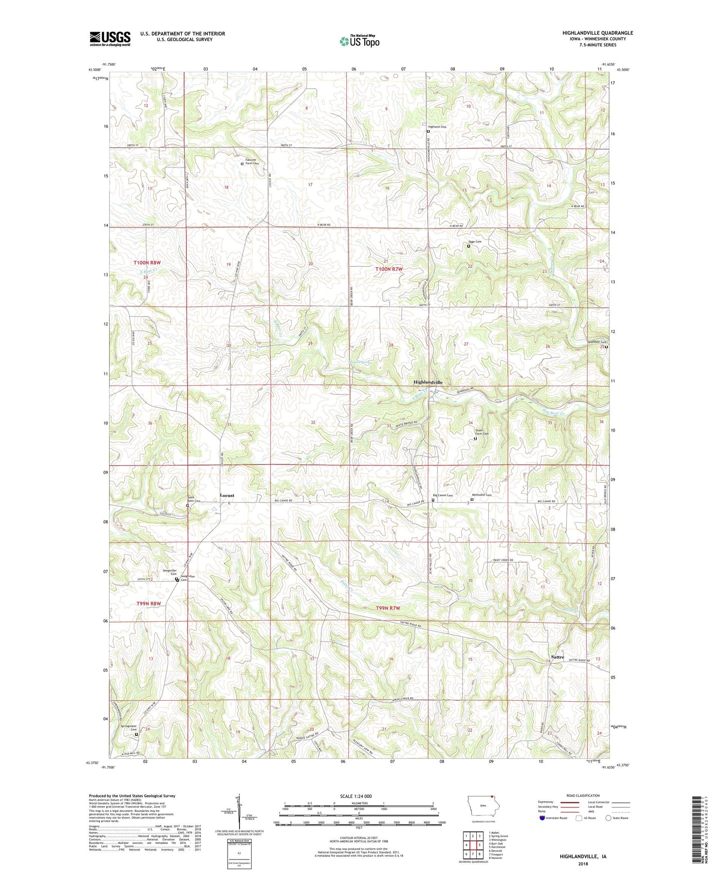
2022 topographic map quadrangle Highlandville in the state of Iowa. Scale: 1:24000. Based on the newly updated USGS 7.5' US Topo map series, this map is in the following counties: Winneshiek. The map contains contour data, water features, and other items you are used to seeing on USGS maps, but also has updated roads and other features. This is the next generation of topographic maps. Printed on high-quality waterproof paper with UV fade-resistant inks.
Quads adjacent to this one:
West: Burr Oak
Northwest: Mabel
North: Spring Grove
Northeast: Wilmington
East: Dorchester
Southeast: Hanover
South: Freeport
Southwest: Decorah
This map covers the same area as the classic USGS quad with code o43091d6.
Contains the following named places: Aquilla Grove Post Office, Big Canoe Cemetery, Big Canoe Church, Big Canoe Norwegian Methodist Cemetery, Egge Cemetery, Eide Post Office, Fawcett Farm Cemetery, Highland Cemetery, Highland Church, Highlandville, Highlandville Post Office, Locust, Locust Cemetery, Locust Lane Salem Cemetery, Locust Post Office, Locust School, Mestad Spring, Mestad Spring Access Area, North Bear Creek Access Area, Quandahl Cemetery, Saint John Church, Sampson Post Office, Sattre, Sattre Post Office, Seegmiller Cemetery, South Bear Creek Access Area, South Bear Park, South Pine Wildlife Management Area, Springwater, Springwater Cemetery, Springwater Church, Springwater Post Office, Stoen Farm Cemetery, Township of Highland, Township of Pleasant