MyTopo
Freeport Iowa US Topo Map
Couldn't load pickup availability
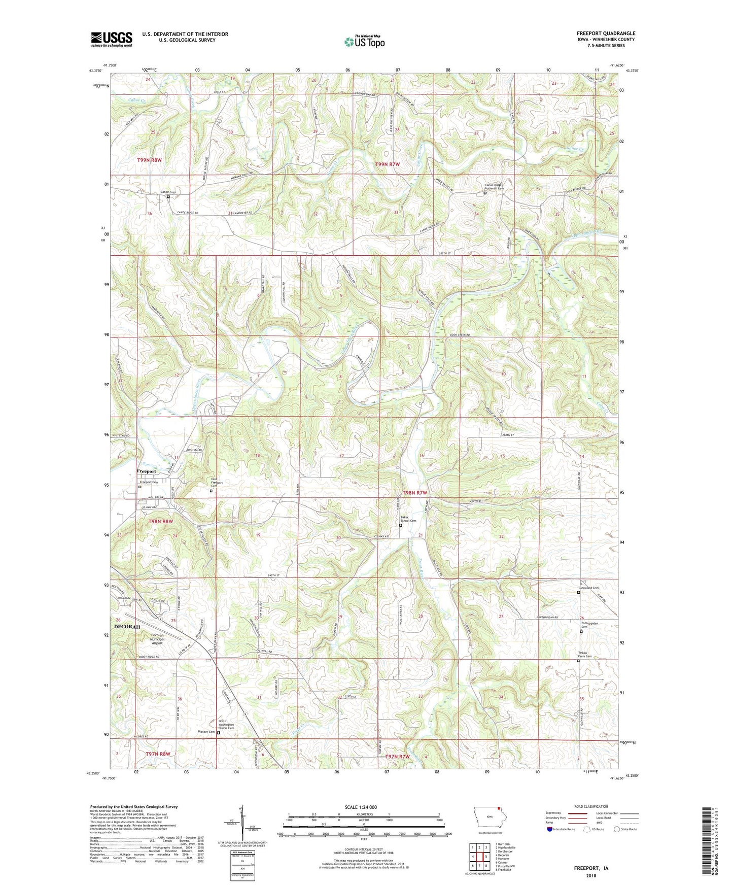
2022 topographic map quadrangle Freeport in the state of Iowa. Scale: 1:24000. Based on the newly updated USGS 7.5' US Topo map series, this map is in the following counties: Winneshiek. The map contains contour data, water features, and other items you are used to seeing on USGS maps, but also has updated roads and other features. This is the next generation of topographic maps. Printed on high-quality waterproof paper with UV fade-resistant inks.
Quads adjacent to this one:
West: Decorah
Northwest: Burr Oak
North: Highlandville
Northeast: Dorchester
East: Hanover
Southeast: Frankville
South: Postville NW
Southwest: Calmar
This map covers the same area as the classic USGS quad with code o43091c6.
Contains the following named places: Canoe, Canoe Cemetery, Canoe Church, Canoe Creek Access Area, Canoe Creek Wildlife Management Area, Canoe Post Office, Canoe Ridge Cemetery, Canoe Ridge Church, Coon Creek, Decorah Municipal Airport, East Freeport Cemetery, Freeport, Freeport Cemetery, Freeport Park, Freeport Post Office, Glenwood Cemetery, Glenwood Church, Glenwood Lutheran Cemetery, Isted Post Office, Merlin Moe Park, Nasset, Nasset Post Office, North Washington Prairie Cemetery, Oneota Country Club, Oneota Riverview Care Facility, Pioneer Cemetery, Pontoppidan Cemetery, Scandinavian Methodist - Episcopal Cemetery, Thoten, Thoten Post Office, Township of Glenwood, Trout Creek, Trout River, Trout River Access Area, Washington Prairie Post Office, Woodville Post Office