MyTopo
Jefferson East Iowa US Topo Map
Couldn't load pickup availability
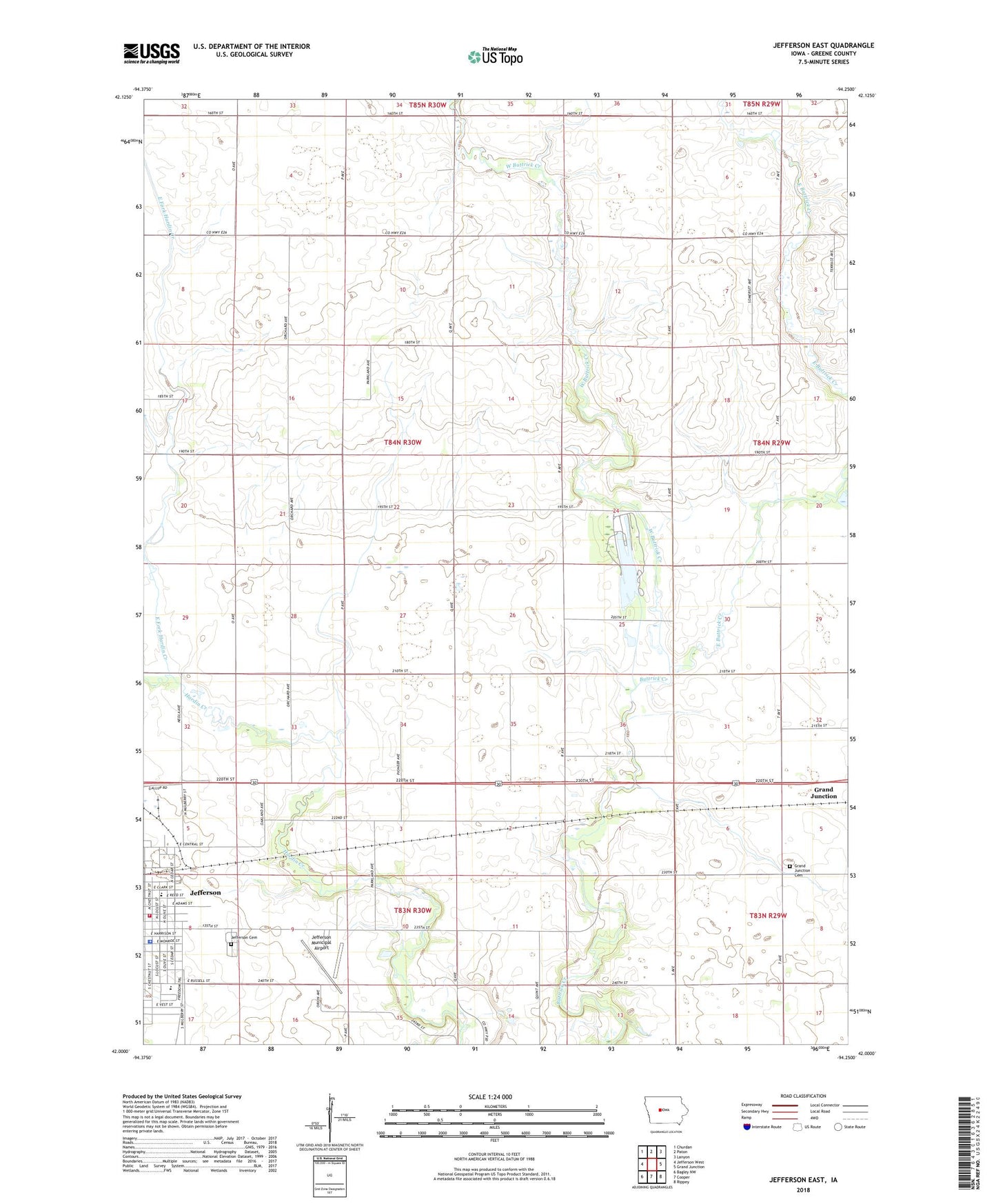
2022 topographic map quadrangle Jefferson East in the state of Iowa. Scale: 1:24000. Based on the newly updated USGS 7.5' US Topo map series, this map is in the following counties: Greene. The map contains contour data, water features, and other items you are used to seeing on USGS maps, but also has updated roads and other features. This is the next generation of topographic maps. Printed on high-quality waterproof paper with UV fade-resistant inks.
Quads adjacent to this one:
West: Jefferson West
Northwest: Churdan
North: Paton
Northeast: Lanyon
East: Grand Junction
Southeast: Rippey
South: Cooper
Southwest: Bagley NW
This map covers the same area as the classic USGS quad with code o42094a3.
Contains the following named places: Abraham Lincoln Statue, Bristol Number Seven School, East Buttrick Creek, East Fork Hardin Creek, Eye Care Associates Center, First Assembly of God Church, First Baptist Church, First United Methodist Church, Grand Junction Cemetery, Gravel Pit, Greene County Courthouse, Greene County Elementary School, Greene County Fairgrounds, Greene County Historical Museum, Greene County Law Enforcement Center, Hill Golf Course, Jefferson - Scranton Alternative High School, Jefferson Cemetery, Jefferson City Hall, Jefferson Eye Care Center, Jefferson Municipal Airport, Jefferson Softball Park, Jefferson Volunteer Fire Department, Jefferson Water Plant, Juhl Hog Farm, KLSN-FM (Jefferson), Lakeside Golf Course, Lindsey Memorial, Milwaukee Railroad Depot, Russell Park, Saint Joseph's Catholic Church, Scheueman Prairie, Spring Lake, Spring Lake County Park, Township of Hardin, West Buttrick Creek, West Central Co-op Elevator