MyTopo
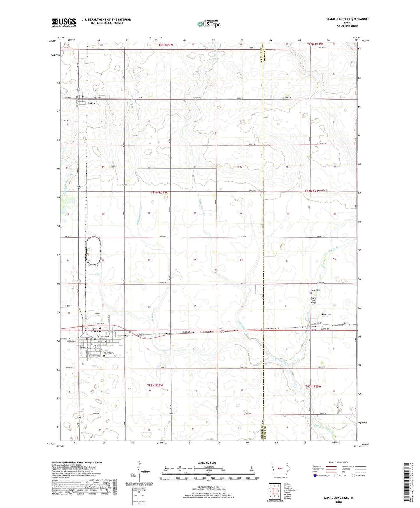
Grand Junction Iowa US Topo Map
Couldn't load pickup availability
2022 topographic map quadrangle Grand Junction in the state of Iowa. Scale: 1:24000. Based on the newly updated USGS 7.5' US Topo map series, this map is in the following counties: Greene, Boone. The map contains contour data, water features, and other items you are used to seeing on USGS maps, but also has updated roads and other features. This is the next generation of topographic maps. Printed on high-quality waterproof paper with UV fade-resistant inks.
Quads adjacent to this one:
West: Jefferson East
Northwest: Paton
North: Lanyon
Northeast: Boxholm
East: Ogden
Southeast: Berkley
South: Rippey
Southwest: Cooper
This map covers the same area as the classic USGS quad with code o42094a2.
Contains the following named places: Beaver, Beaver Cemetery, Beaver Church of the Brethren, Beaver Creek Bridge, Beaver Post Office, City of Beaver, City of Dana, City of Grand Junction, Crouse Park, Dana, Dana Post Office, Grand Junction, Grand Junction City Hall, Grand Junction Fire and Rescue Unit, Grand Junction Library, Grand Junction Post Office, Greene County Intermediate School, Little Beaver Creek, Mount Calvary Cemetery, Pound Pits, Presbyterian Church, Saint Brigid's Catholic Church, Saint Johns Church, Township of Junction, United Methodist Church, West Beaver Creek, ZIP Codes: 50064, 50107