MyTopo
Lake City Iowa US Topo Map
Couldn't load pickup availability
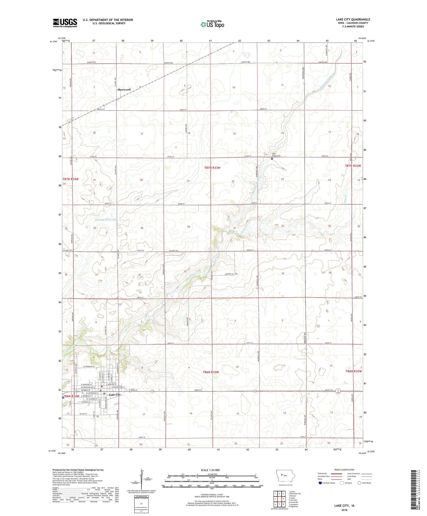
2022 topographic map quadrangle Lake City in the state of Iowa. Scale: 1:24000. Based on the newly updated USGS 7.5' US Topo map series, this map is in the following counties: Calhoun. The map contains contour data, water features, and other items you are used to seeing on USGS maps, but also has updated roads and other features. This is the next generation of topographic maps. Printed on high-quality waterproof paper with UV fade-resistant inks.
Quads adjacent to this one:
West: Yetter
Northwest: Lytton
North: Rockwell City
Northeast: Richard
East: Lohrville
Southeast: Wightman
South: Lanesboro
Southwest: Carroll NE
This map covers the same area as the classic USGS quad with code o42094c6.
Contains the following named places: Central School Museum, City of Lake City, Community Fellowship Christian Church, Drainage Ditch 10, Drainage Ditch 198, Farmers Cooperative Company Elevator, First American Baptist Church, Goins Memorial Park, Kingdom Hall of Jehovah's Witnesses, Lake City, Lake City City Hall, Lake City Community Building, Lake City Country Club, Lake City Library, Lake City Medical Clinic, Lake City Police Department, Lake City Post Office, Lake City Union Church, Lake Creek Cemetery, Lincoln School, Logan Wildlife Area, McFarland Clinic at Lake City, Mike Macke Memorial Park, Pilgrim Lutheran Church, Pond Creek Lake, Rock Vision Clinic, Saint Joseph's Catholic Church, Saint Mary's Catholic Church, Seventh Day Adventist Church, Sherwood, Sherwood Post Office, South Central Calhoun High School, Stewart Memorial Community Hospital, Stewart Memorial Hospital Heliport, Township of Calhoun, Township of Lake Creek, Woodlawn Christian Church, ZIP Code: 51449