MyTopo
Lohrville Iowa US Topo Map
Couldn't load pickup availability
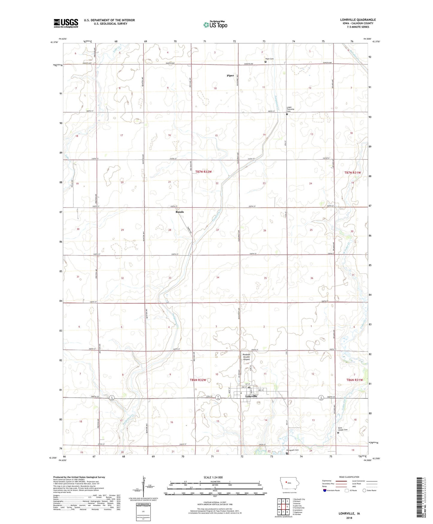
2022 topographic map quadrangle Lohrville in the state of Iowa. Scale: 1:24000. Based on the newly updated USGS 7.5' US Topo map series, this map is in the following counties: Calhoun. The map contains contour data, water features, and other items you are used to seeing on USGS maps, but also has updated roads and other features. This is the next generation of topographic maps. Printed on high-quality waterproof paper with UV fade-resistant inks.
Quads adjacent to this one:
West: Lake City
Northwest: Rockwell City
North: Richard
Northeast: Knierim
East: Farnhamville
Southeast: Churdan
South: Wightman
Southwest: Lanesboro
This map covers the same area as the classic USGS quad with code o42094c5.
Contains the following named places: Calhoun Post Office, Christian Church, Church of Christ, City of Lohrville, East Cedar Creek, Evergreen Cemetery, J J Hands Library, Johnson Prairie, Logan Township Cemetery, Lohrville, Lohrville Ambulance Service, Lohrville City Hall, Lohrville Fire Station, Lohrville Post Office, New Cooperative Incorporated Elevator, Piper, Piper Cemetery, Rands, Rands Post Office, Riedesel Private Airport, Saint Joseph Cemetery, Saint Joseph Church, Share Group Fellowship Church, South Central Calhoun Elementary School - Lohrville, Stimsons, Township of Logan, Township of Union, United Methodist Church, University Forty County Park, West Cedar Creek, ZIP Code: 51453