MyTopo
Maurice Iowa US Topo Map
Couldn't load pickup availability
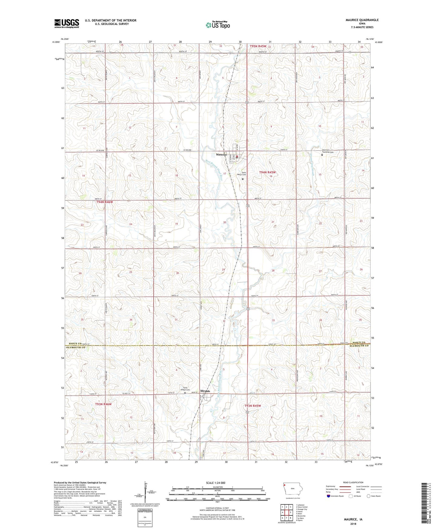
2022 topographic map quadrangle Maurice in the state of Iowa. Scale: 1:24000. Based on the newly updated USGS 7.5' US Topo map series, this map is in the following counties: Sioux, Plymouth. The map contains contour data, water features, and other items you are used to seeing on USGS maps, but also has updated roads and other features. This is the next generation of topographic maps. Printed on high-quality waterproof paper with UV fade-resistant inks.
Quads adjacent to this one:
West: Ireton
Northwest: Lebanon
North: Sioux Center
Northeast: Orange City
East: Alton
Southeast: Oyens
South: Le Mars
Southwest: Brunsville
This map covers the same area as the classic USGS quad with code o42096h2.
Contains the following named places: Alberson Dairy, Bos Dairy, City of Maurice, City of Struble, First Reformed Church, Kuiken Farms, Maassen Dairy, Maurice, Maurice Fire Department First Responders, Maurice Post Office, Midwest Farmers Co-op Association Elevator, Orange City Slough, Oshdosh Post Office, Ruhland Farms, Saint Joseph Cemetery, Saint Joseph Church, Saint Marys Cemetery, Sherman Township Cemetery, Sioux County Regional Airport, Struble, Struble Post Office, Township of Sherman, W G Farms, ZIP Code: 51036