MyTopo
Mount Zion Iowa US Topo Map
Couldn't load pickup availability
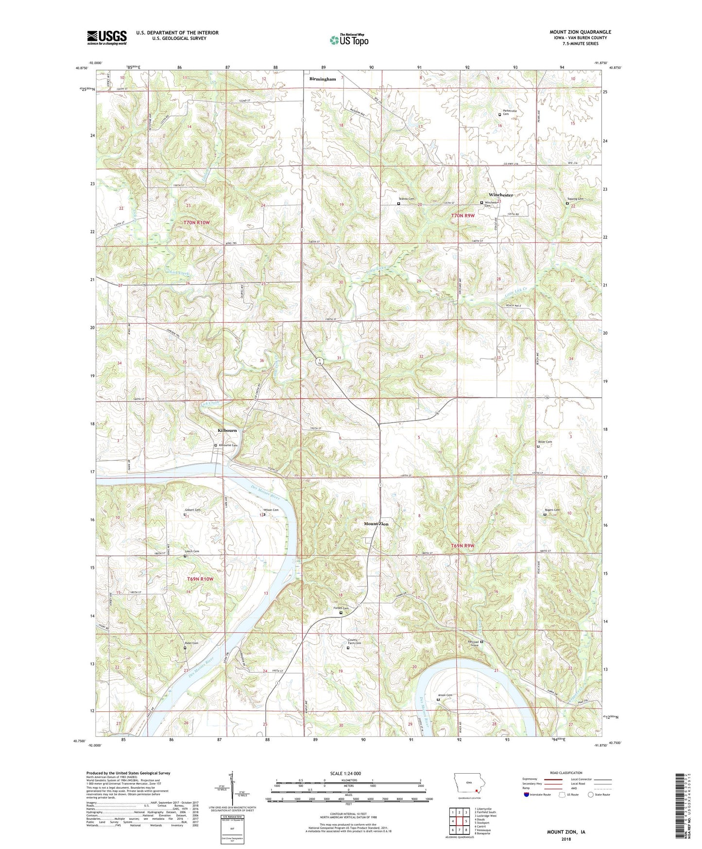
2022 topographic map quadrangle Mount Zion in the state of Iowa. Scale: 1:24000. Based on the newly updated USGS 7.5' US Topo map series, this map is in the following counties: Van Buren. The map contains contour data, water features, and other items you are used to seeing on USGS maps, but also has updated roads and other features. This is the next generation of topographic maps. Printed on high-quality waterproof paper with UV fade-resistant inks.
Quads adjacent to this one:
West: Douds
Northwest: Libertyville
North: Fairfield South
Northeast: Lockridge West
East: Stockport
Southeast: Bonaparte
South: Keosauqua
Southwest: Cantril
This map covers the same area as the classic USGS quad with code o40091g8.
Contains the following named places: Anson Cemetery, Austin County Park, County Farm Cemetery, Forbes Cemetery, Gilbert Cemetery, Kilbourn, Kilbourn Post Office, Kilbourne Cemetery, Leech Cemetery, Lick Creek, Little Creek, Little Lick Creek, Miller Chapel Cemetery, Mount Zion, Mount Zion Church, Mount Zion Post Office, Parkerville Cemetery, Parksville, Railroad Grave, Rider Cemetery, Rock Creek, Rogers Cemetery, Tedrow Cemetery, Topping Cemetery, Township of Union, Township of Van Buren, Union Post Office, Van Buren County, Van Buren County Home, Wilson Cemetery, Winchester, Winchester Cemetery, Winchester Post Office, ZIP Code: 52535