MyTopo
New London Iowa US Topo Map
Couldn't load pickup availability
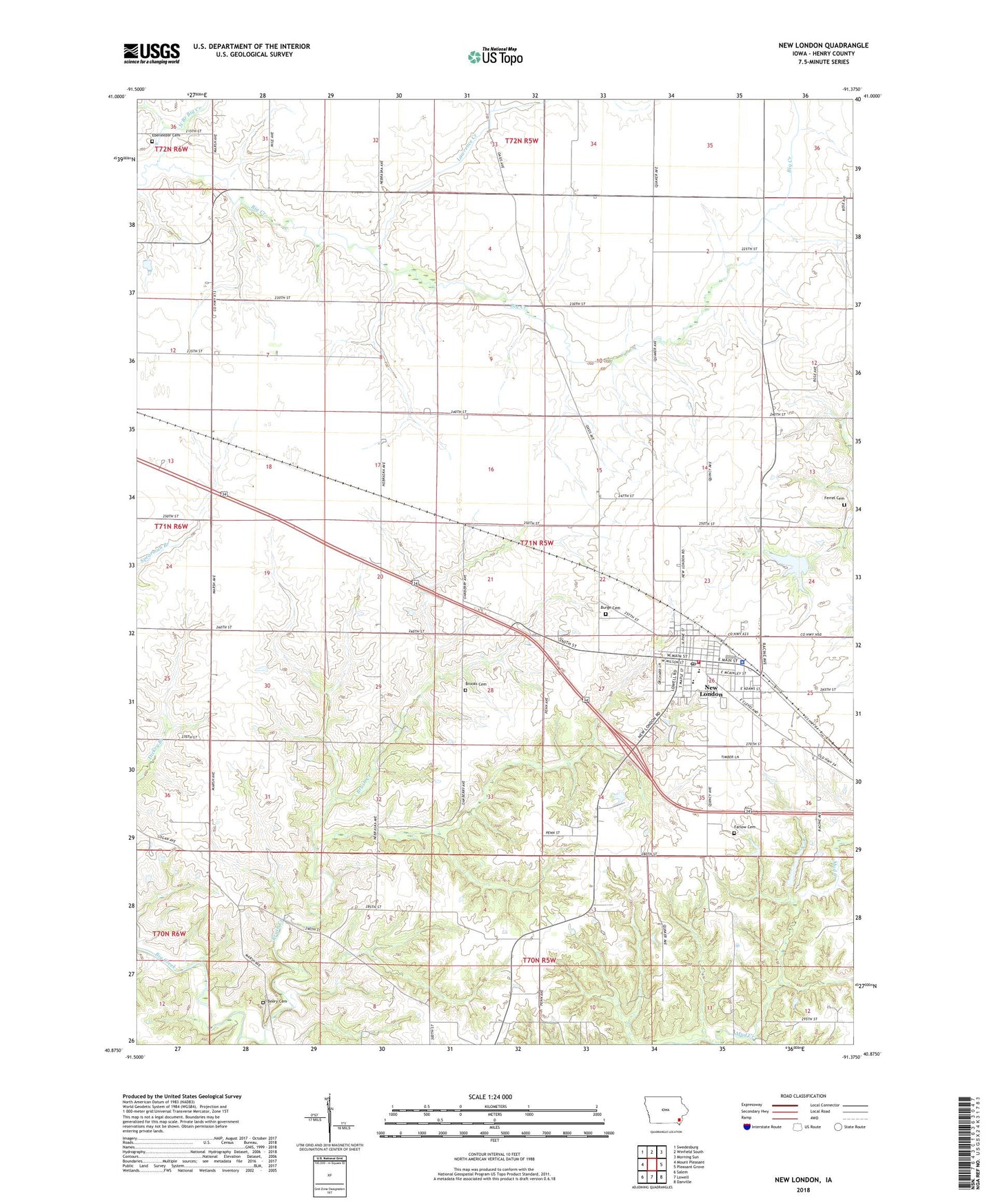
2022 topographic map quadrangle New London in the state of Iowa. Scale: 1:24000. Based on the newly updated USGS 7.5' US Topo map series, this map is in the following counties: Henry. The map contains contour data, water features, and other items you are used to seeing on USGS maps, but also has updated roads and other features. This is the next generation of topographic maps. Printed on high-quality waterproof paper with UV fade-resistant inks.
Quads adjacent to this one:
West: Mount Pleasant
Northwest: Swedesburg
North: Winfield South
Northeast: Morning Sun
East: Pleasant Grove
Southeast: Danville
South: Lowell
Southwest: Salem
This map covers the same area as the classic USGS quad with code o40091h4.
Contains the following named places: Beery Cemetery, Brooks Cemetery, Brush Creek, Burge Cemetery, Central Park, City of New London, Clark Elementary School, Deerwood Golf Club, Dover Historical Museum, Ebeneezer Cemetery, Farlow Cemetery, Ferrel Cemetery, Lawrence Creek, N J Nugen Public Library, New London, New London Christian Church, New London City Fire Station, New London City Police Department, New London Country Club, New London Farmers Co-op Elevator, New London Junior - Senior High School, New London Nursing and Rehabilitation Center, New London Post Office, New Londons First Store and Select School Historical Marker, North Branch Big Creek, Orr-Port Airport, Presbyterian Church, Shinar Cumberland Presbyterian Church, Township of New London, United Methodist Church, ZIP Code: 52645