MyTopo
Pleasant Grove Iowa US Topo Map
Couldn't load pickup availability
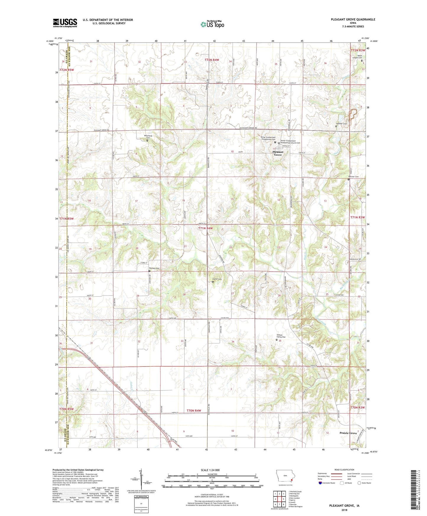
2022 topographic map quadrangle Pleasant Grove in the state of Iowa. Scale: 1:24000. Based on the newly updated USGS 7.5' US Topo map series, this map is in the following counties: Des Moines, Henry. The map contains contour data, water features, and other items you are used to seeing on USGS maps, but also has updated roads and other features. This is the next generation of topographic maps. Printed on high-quality waterproof paper with UV fade-resistant inks.
Quads adjacent to this one:
West: New London
Northwest: Winfield South
North: Morning Sun
Northeast: Mediapolis
East: Sperry
Southeast: West Burlington
South: Danville
Southwest: Lowell
This map covers the same area as the classic USGS quad with code o40091h3.
Contains the following named places: Big Hollow Creek, Butcher Cemetery, Carter Cemetery, Cedar Fork Creek, Fan Post Office, Gallaher Cemetery, Millersburg Cemetery, Pleasant Grove, Pleasantgrove Post Office, Prairie Grove, Ramsey Cemetery, Shinar Cumberland Presbyterian Cemetery, Shinar Cumberland Presbyterian Church Cemetery, Siefken Family Plot, Stage Coach Depot Historical Marker, Township of Pleasant Grove, Welsh Chapel Cemetery, ZIP Code: 52660