MyTopo
Oakville Iowa US Topo Map
Couldn't load pickup availability
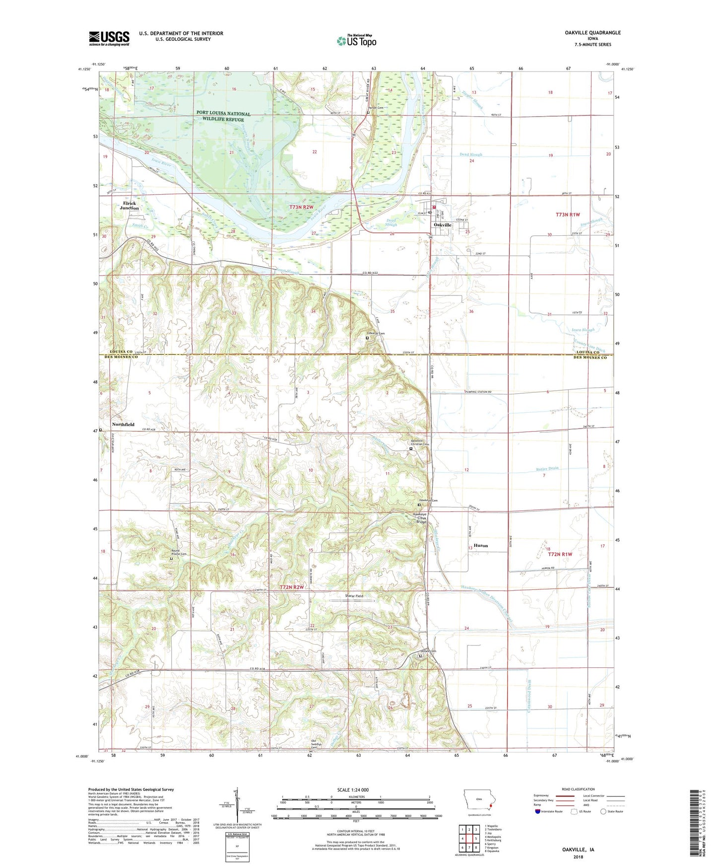
2022 topographic map quadrangle Oakville in the state of Iowa. Scale: 1:24000. Based on the newly updated USGS 7.5' US Topo map series, this map is in the following counties: Des Moines, Louisa. The map contains contour data, water features, and other items you are used to seeing on USGS maps, but also has updated roads and other features. This is the next generation of topographic maps. Printed on high-quality waterproof paper with UV fade-resistant inks.
Quads adjacent to this one:
West: Mediapolis
Northwest: Wapello
North: Toolesboro
Northeast: Joy
East: Keithsburg
Southeast: Oquawka
South: Kingston
Southwest: Sperry
This map covers the same area as the classic USGS quad with code o41091a1.
Contains the following named places: Apostolic Christian Cemetery, Apostolic Christian Church, Apostolic Church, Butler Drain, Cappy Russell Access, Church of God Holiness, City of Oakville, Dead Slough, Diggins Slough, Dolbee Cemetery, Dolbee Creek, Driscol Cave Burial Site, Edwards Cemetery, Elrick Junction, Elrick Post Office, Florence Post Office, Halls Lake, Hawkeye Cemetery, Hawkeye Creek, Hawkeye Creek Bridge, Hawkeye-Dolbee Diversion Channel, Huron, Huron Post Office, Limestone Post Office, Luckenbill Woods, Northfield, Northfield Cemetery, Northfield Post Office, Oakville, Oakville Fire Department, Oakville Post Office, Oakville Town Hall, Old Swedish Church, Palo Alto Post Office, Parson Cemetery, Round Prairie Cemetery, Sharar Field, Smith Creek, Sunfish Lake, Swedish Lutheran Cemetery, Township of Eliot, Township of Huron, United Methodist Church