MyTopo
Plover Iowa US Topo Map
Couldn't load pickup availability
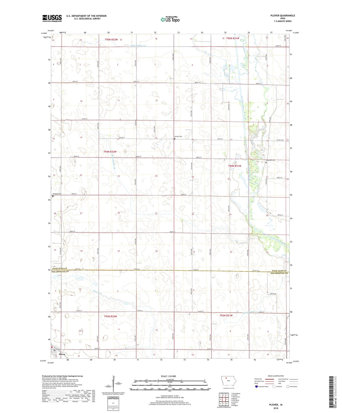
2022 topographic map quadrangle Plover in the state of Iowa. Scale: 1:24000. Based on the newly updated USGS 7.5' US Topo map series, this map is in the following counties: Palo Alto, Pocahontas. The map contains contour data, water features, and other items you are used to seeing on USGS maps, but also has updated roads and other features. This is the next generation of topographic maps. Printed on high-quality waterproof paper with UV fade-resistant inks.
Quads adjacent to this one:
West: Mallard
Northwest: Emmetsburg
North: Cylinder
Northeast: Whittemore
East: West Bend
Southeast: Bradgate
South: Rolfe
Southwest: Havelock
This map covers the same area as the classic USGS quad with code o42094h5.
Contains the following named places: City of Plover, Cylinder Creek, Ditch Number 123, Ditch Number 17, Ditch Number 48, Ellington Cemetery, Lincoln Cemetery, Meredith Park, Plover, Plover Post Office, Plover Powhatten Fire Department, Plover Public Library, Plover Town Hall, Poplar Grove Post Office, River Runner Access, Riverside Cemetery, Township of Ellington, Township of West Bend, United Methodist Church, West Des Moines River Canoe Stop, West Fork Wetlands, ZIP Code: 50573