MyTopo
Bradgate Iowa US Topo Map
Couldn't load pickup availability
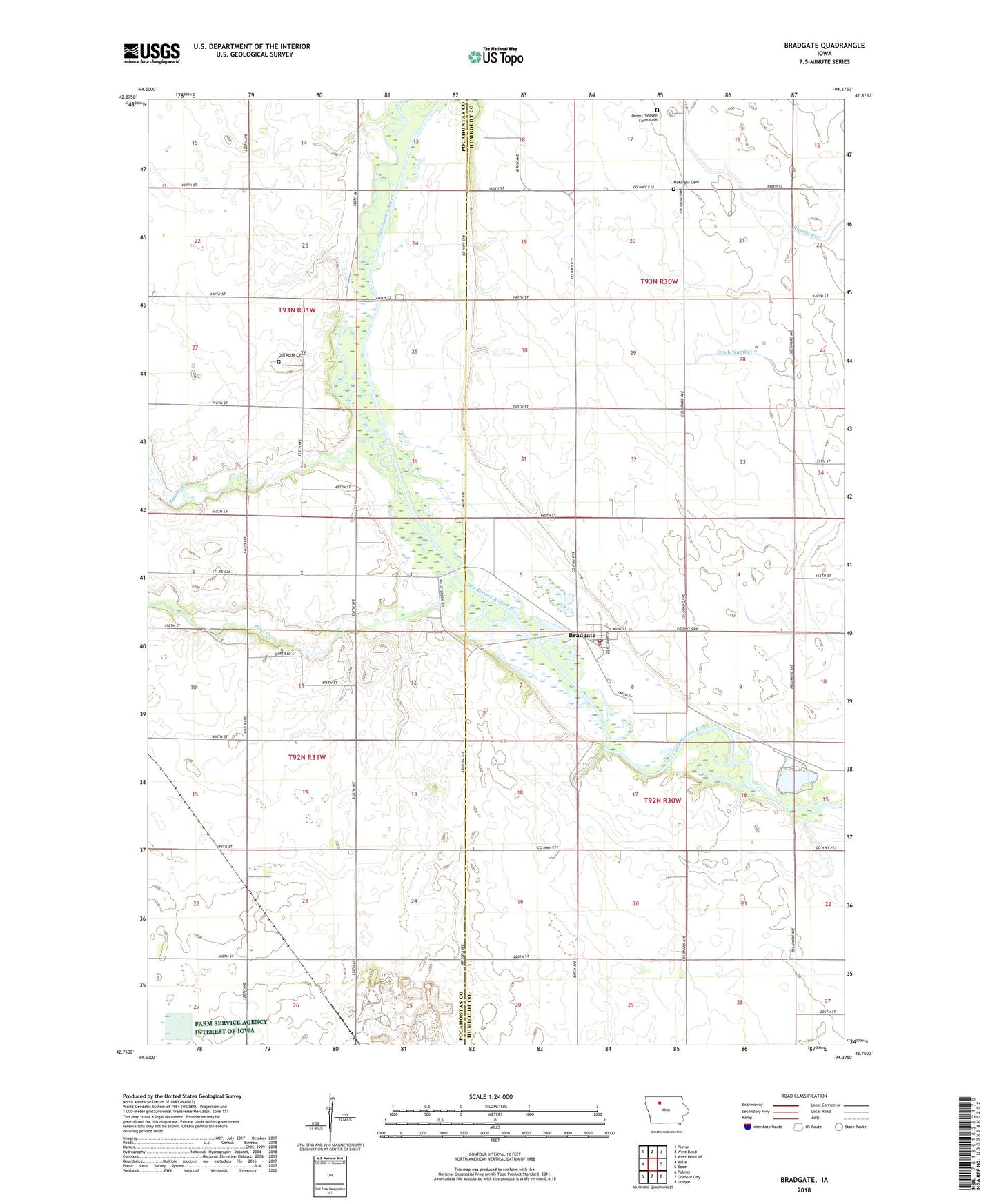
2022 topographic map quadrangle Bradgate in the state of Iowa. Scale: 1:24000. Based on the newly updated USGS 7.5' US Topo map series, this map is in the following counties: Humboldt, Pocahontas. The map contains contour data, water features, and other items you are used to seeing on USGS maps, but also has updated roads and other features. This is the next generation of topographic maps. Printed on high-quality waterproof paper with UV fade-resistant inks.
Quads adjacent to this one:
West: Rolfe
Northwest: Plover
North: West Bend
Northeast: West Bend NE
East: Bode
Southeast: Unique
South: Gilmore City
Southwest: Palmer
This map covers the same area as the classic USGS quad with code o42094g4.
Contains the following named places: Beaver Creek, Ben Lomond Post Office, Bradgate, Bradgate Fire Department, Bradgate Post Office, Bradgate State Fishing Access, City of Bradgate, Hamms Bridge Access, KTIN-TV (Fort Dodge), KTPR-FM (Fort Dodge), McKnight Cemetery, Moore Quarry, Old Rolfe Cemetery, Omer-Thorsen Farm Cemetery, Park Grove Post Office, Parvin Post Office, Pilot Creek, Pilot Creek County Park, Pilot Creek Wildlife Area, Pro Cooperative Elevator, Ripperger Woods, Rolfe, Schlensig Wildlife Area, Township of Avery, Township of Wacousta, Wacousta Post Office, Willow Glen Post Office, Willow Grove, Willows Access, ZIP Code: 50520