MyTopo
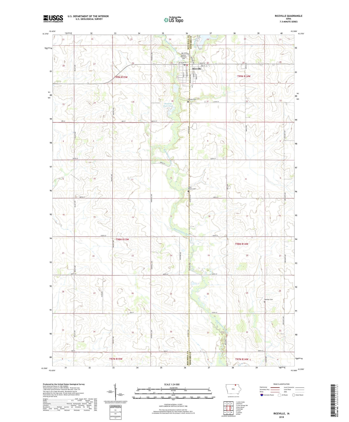
Riceville Iowa US Topo Map
Couldn't load pickup availability
2022 topographic map quadrangle Riceville in the state of Iowa. Scale: 1:24000. Based on the newly updated USGS 7.5' US Topo map series, this map is in the following counties: Mitchell, Howard. The map contains contour data, water features, and other items you are used to seeing on USGS maps, but also has updated roads and other features. This is the next generation of topographic maps. Printed on high-quality waterproof paper with UV fade-resistant inks.
Quads adjacent to this one:
West: New Haven
Northwest: Little Cedar
North: McIntire
Northeast: Lime Springs NW
East: Saratoga
Southeast: Elma
South: Colwell
Southwest: Floyd
This map covers the same area as the classic USGS quad with code o43092c5.
Contains the following named places: Acme Post Office, Calvary Cemetery, City of Riceville, Congregational Church, Doran Post Office, Farmers Feed and Grain Company Elevator, Jamestown Highway Rest Area, Lake Hendricks, Lake Hendricks Dam, Lake Hendricks Park, Lowther Station, Mitchell County Regional Center, Myers Farm, Nelson, Nelson Post Office, Reckner Cemetery, Riceville, Riceville Ambulance Service, Riceville City Hall, Riceville Community Center, Riceville Community Rest Home, Riceville Country Club, Riceville Elementary School, Riceville Fire Department, Riceville High School, Riceville Library, Riceville Post Office, Riverside Cemetery, Saint Peters Lutheran Cemetery, Sleeping Duck Pond, Township of Douglas, United Methodist Church, Watsons Creek