MyTopo
Floyd Iowa US Topo Map
Couldn't load pickup availability
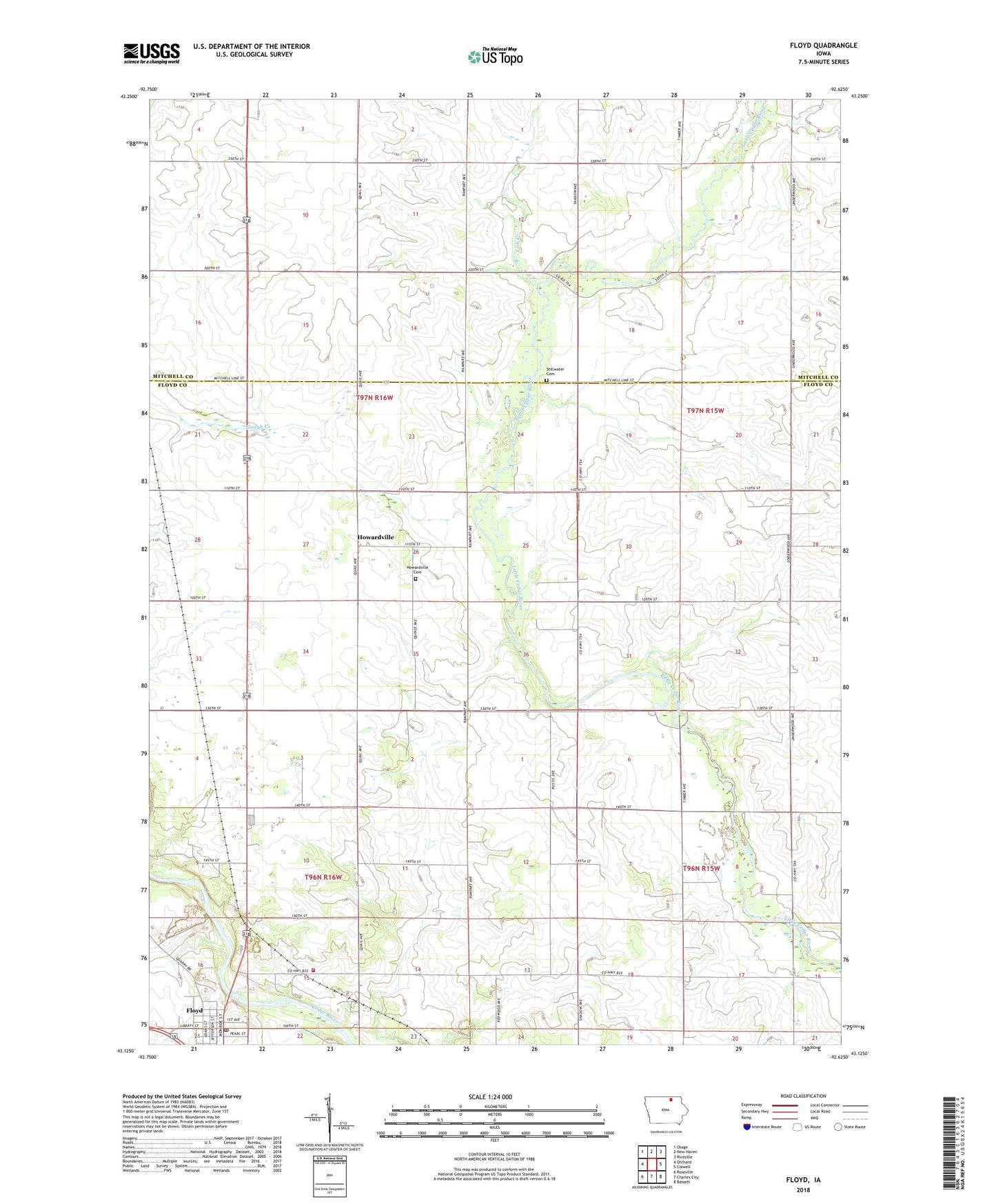
2022 topographic map quadrangle Floyd in the state of Iowa. Scale: 1:24000. Based on the newly updated USGS 7.5' US Topo map series, this map is in the following counties: Floyd, Mitchell. The map contains contour data, water features, and other items you are used to seeing on USGS maps, but also has updated roads and other features. This is the next generation of topographic maps. Printed on high-quality waterproof paper with UV fade-resistant inks.
Quads adjacent to this one:
West: Orchard
Northwest: Osage
North: New Haven
Northeast: Riceville
East: Colwell
Southeast: Bassett
South: Charles City
Southwest: Roseville
This map covers the same area as the classic USGS quad with code o43092b6.
Contains the following named places: City of Floyd, Colwell County Park, East Lincoln Townhall, Fish Creek, Floyd, Floyd City Hall, Floyd Park, Floyd Post Office, Floyd Station, Floyd Volunteer Fire Department, Gospel Lighthouse Church, Grace United Methodist Church, Henry Airport, Howardville, Howardville Cemetery, Howardville Post Office, Howardville Wesleyan Church, Nilesville, Nilesville Post Office, Restoration Marsh, Slough Creek Park, Stillwater Cemetery, Stillwater Post Office, Township of Cedar, Township of East Lincoln, Township of West Lincoln, Wentlands Woods, ZIP Code: 50460