MyTopo
Rockford Iowa US Topo Map
Couldn't load pickup availability
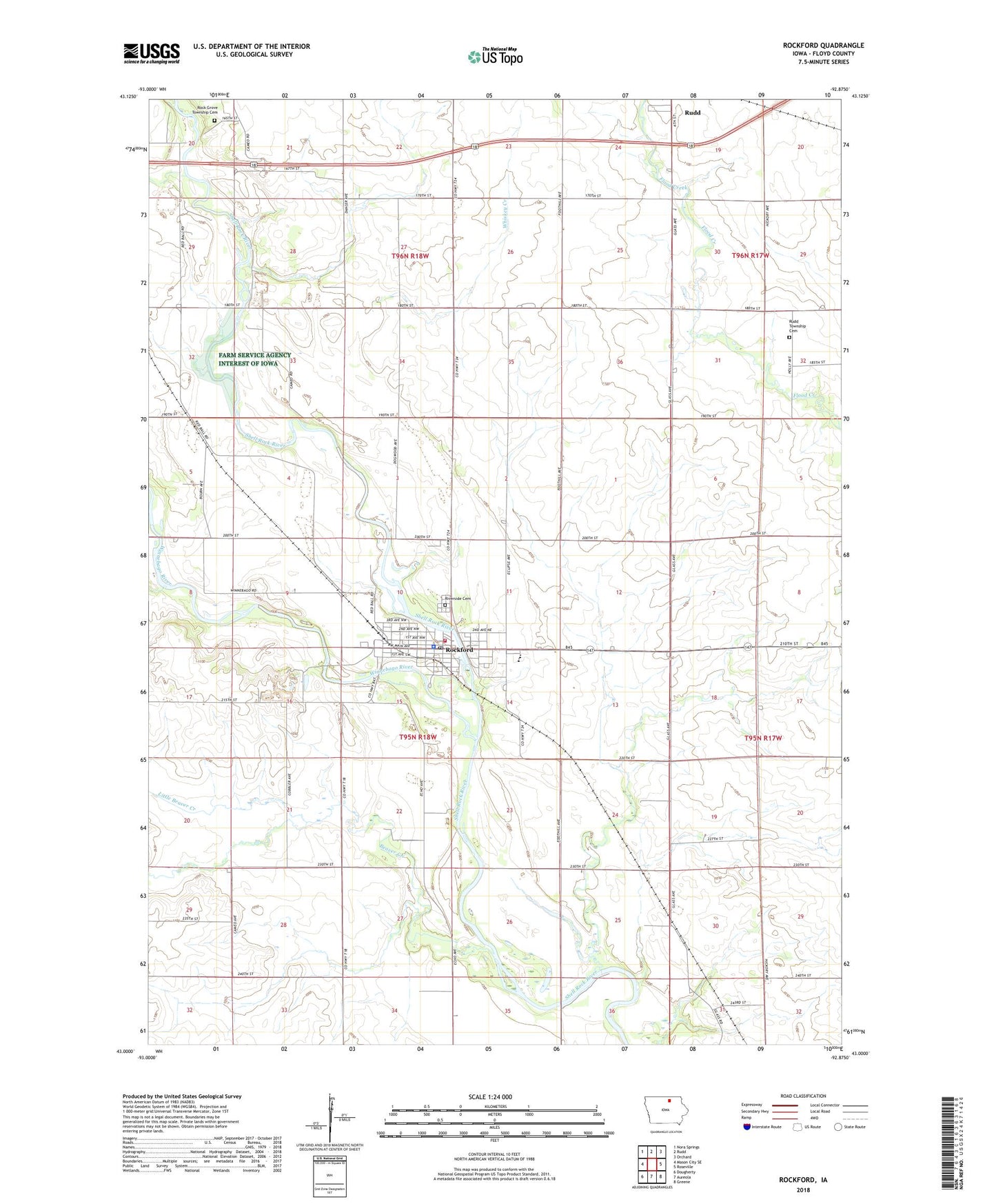
2022 topographic map quadrangle Rockford in the state of Iowa. Scale: 1:24000. Based on the newly updated USGS 7.5' US Topo map series, this map is in the following counties: Floyd. The map contains contour data, water features, and other items you are used to seeing on USGS maps, but also has updated roads and other features. This is the next generation of topographic maps. Printed on high-quality waterproof paper with UV fade-resistant inks.
Quads adjacent to this one:
West: Mason City SE
Northwest: Nora Springs
North: Rudd
Northeast: Orchard
East: Roseville
Southeast: Greene
South: Aureola
Southwest: Dougherty
This map covers the same area as the classic USGS quad with code o43092a8.
Contains the following named places: Beaver Creek, City of Rockford, First United Methodist Church, Holy Name Church, Little Beaver Creek, Nagle Wildlife Area, Prairieland Chiropractic Center, Riverside Cemetery, Rock Grove Township Cemetery, Rockford, Rockford Baptist Church, Rockford City Hall, Rockford Fire Department, Rockford Fossil and Praire Park, Rockford Golf and Country Club, Rockford Medical Clinic, Rockford Park, Rockford Police Department, Rockford Post Office, Rockford Public Library, Rudd - Rockford - Marble Rock Elementary School, Rudd Rockford Marble - Rock Senior / Junior High School, Rudd Township Cemetery, Township of Rockford, Whiskey Creek, Winnebago River, Zion Lutheran Church, ZIP Code: 50468