MyTopo
Dougherty Iowa US Topo Map
Couldn't load pickup availability
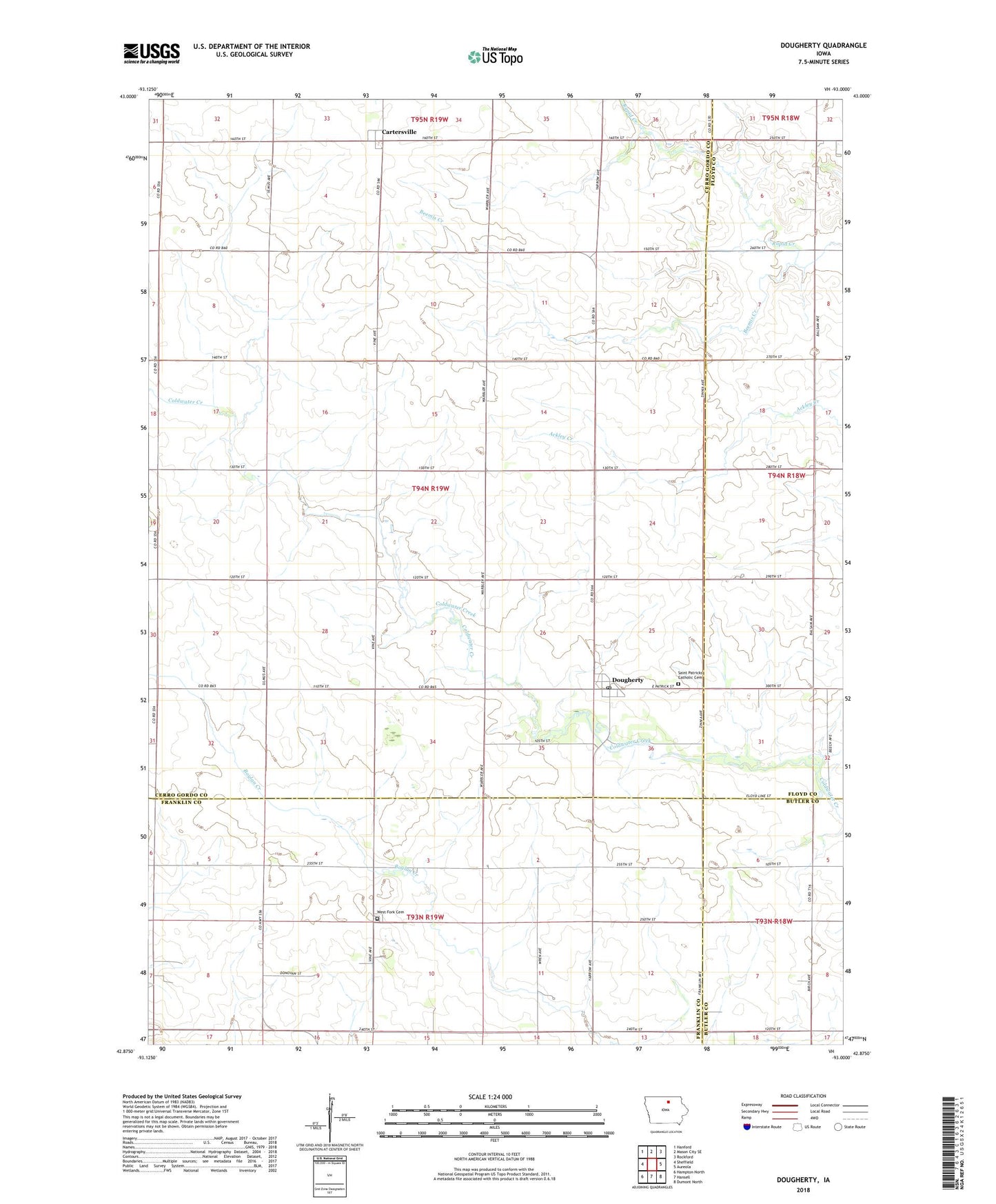
2022 topographic map quadrangle Dougherty in the state of Iowa. Scale: 1:24000. Based on the newly updated USGS 7.5' US Topo map series, this map is in the following counties: Cerro Gordo, Franklin, Floyd, Butler. The map contains contour data, water features, and other items you are used to seeing on USGS maps, but also has updated roads and other features. This is the next generation of topographic maps. Printed on high-quality waterproof paper with UV fade-resistant inks.
Quads adjacent to this one:
West: Sheffield
Northwest: Hanford
North: Mason City SE
Northeast: Rockford
East: Aureola
Southeast: Dumont North
South: Hansell
Southwest: Hampton North
This map covers the same area as the classic USGS quad with code o42093h1.
Contains the following named places: Cartersville, Cartersville Elevator Incorporated Elevator, Cartersville Post Office, City of Dougherty, Coldwater Post Office, Dougherty, Dougherty First Responders, Dougherty Post Office, Dougherty Town Hall, Hackberry Post Office, Ingham Post Office, Rapid Creek, Saint Patricks Catholic Cemetery, Saint Patricks Church, Saint Patricks School, Township of Dougherty, West Fork Cemetery, ZIP Code: 50433