MyTopo
Sac City East Iowa US Topo Map
Couldn't load pickup availability
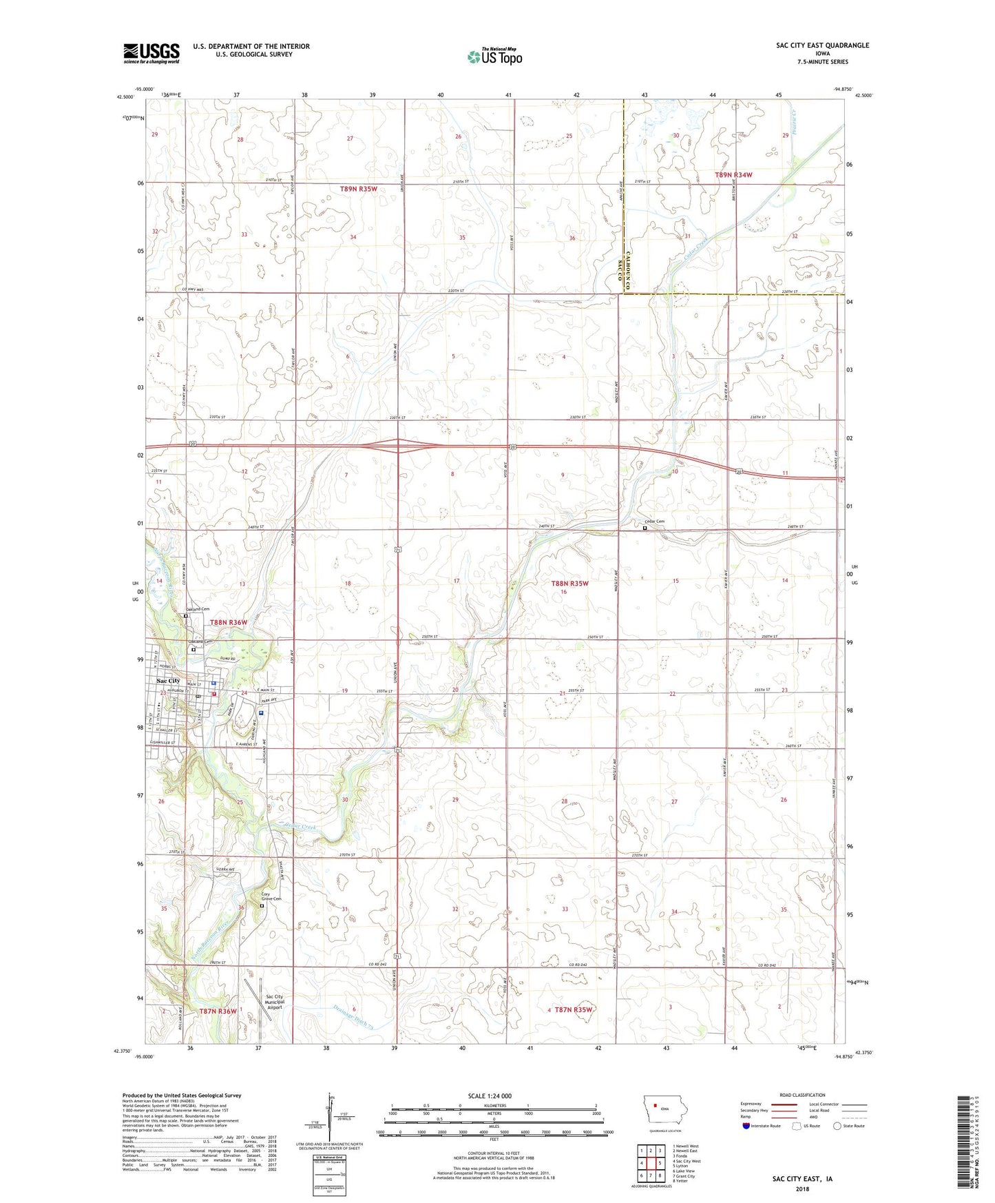
2022 topographic map quadrangle Sac City East in the state of Iowa. Scale: 1:24000. Based on the newly updated USGS 7.5' US Topo map series, this map is in the following counties: Sac, Calhoun. The map contains contour data, water features, and other items you are used to seeing on USGS maps, but also has updated roads and other features. This is the next generation of topographic maps. Printed on high-quality waterproof paper with UV fade-resistant inks.
Quads adjacent to this one:
West: Sac City West
Northwest: Newell West
North: Newell East
Northeast: Fonda
East: Lytton
Southeast: Yetter
South: Grant City
Southwest: Lake View
This map covers the same area as the classic USGS quad with code o42094d8.
Contains the following named places: Cedar Cemetery, Cedar Creek, Chautauqua Building, City of Sac City, Cory Grove Cemetery, Early Mansion, East Sac County Middle School, Faith Bible Church, Family Eye Care Center, First Baptist Church, First Christian Church, First Presbyterian Church, Hagge County Park, Jackson Number Seven School, Lions Park, Loring Hospital, Oakland Cemetery, Park View Care Center, Prairie Creek, Sac City, Sac City Access, Sac City Community Building, Sac City Fire Department, Sac City Library, Sac City Municipal Airport, Sac City Park, Sac City Police Department, Sac City Post Office, Sac Community Recreation Center, Sac Country Club, Sac County Ambulance Service, Sac County Courthouse, Sac County Fairgrounds, Sac County Historical Museum, Sac County Sheriff's Office, Saint Marys Catholic Church, Saint Pauls Lutheran Church, Schoharie Post Office, Soldier Monument, South Park, Tolan Field, Township of Cedar, Trimark Physicians Group Building, United Methodist Church, ZIP Code: 50583