MyTopo
Fonda Iowa US Topo Map
Couldn't load pickup availability
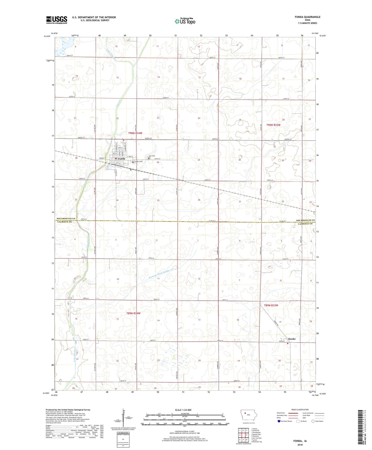
2022 topographic map quadrangle Fonda in the state of Iowa. Scale: 1:24000. Based on the newly updated USGS 7.5' US Topo map series, this map is in the following counties: Pocahontas, Calhoun. The map contains contour data, water features, and other items you are used to seeing on USGS maps, but also has updated roads and other features. This is the next generation of topographic maps. Printed on high-quality waterproof paper with UV fade-resistant inks.
Quads adjacent to this one:
West: Newell East
Northwest: Varina
North: Fonda NE
Northeast: Pocahontas
East: Pomeroy
Southeast: Rockwell City
South: Lytton
Southwest: Sac City East
This map covers the same area as the classic USGS quad with code o42094e7.
Contains the following named places: Cedar Township Cemetery, City of Fonda, Drainage Ditch Number 29, Drainage Ditch Number 37, Fonda, Fonda Ambulance Service, Fonda City Hall, Fonda Golf Course, Fonda Medical Clinic, Fonda Nursing and Rehabilitation Center, Fonda Opera House Museum, Fonda Post Office, Fonda Public Library, Fonda Volunteer Fire Department, Kelly Access Area, Knoke, Knoke Fire Department, Knoke Post Office, Leo Shimon Marsh Wildlife Management Area, Little Cedar Creek, Newell Fonda Community School, Our Lady of Good Counsel Church, Our Lady of Good Counsel School, Presbyterian Church, Saint Pauls Church, Towhead Lake, Towhead Lake State Game Management Area, Townhead Lake State Game Mgt Area, Township of Cedar, Township of Williams, Trimark Physicians Group Center, United Church of Christ, Williams Township Hall, Zion Cemetery, Zion United Methodist Church, ZIP Code: 50540