MyTopo
Swisher Iowa US Topo Map
Couldn't load pickup availability
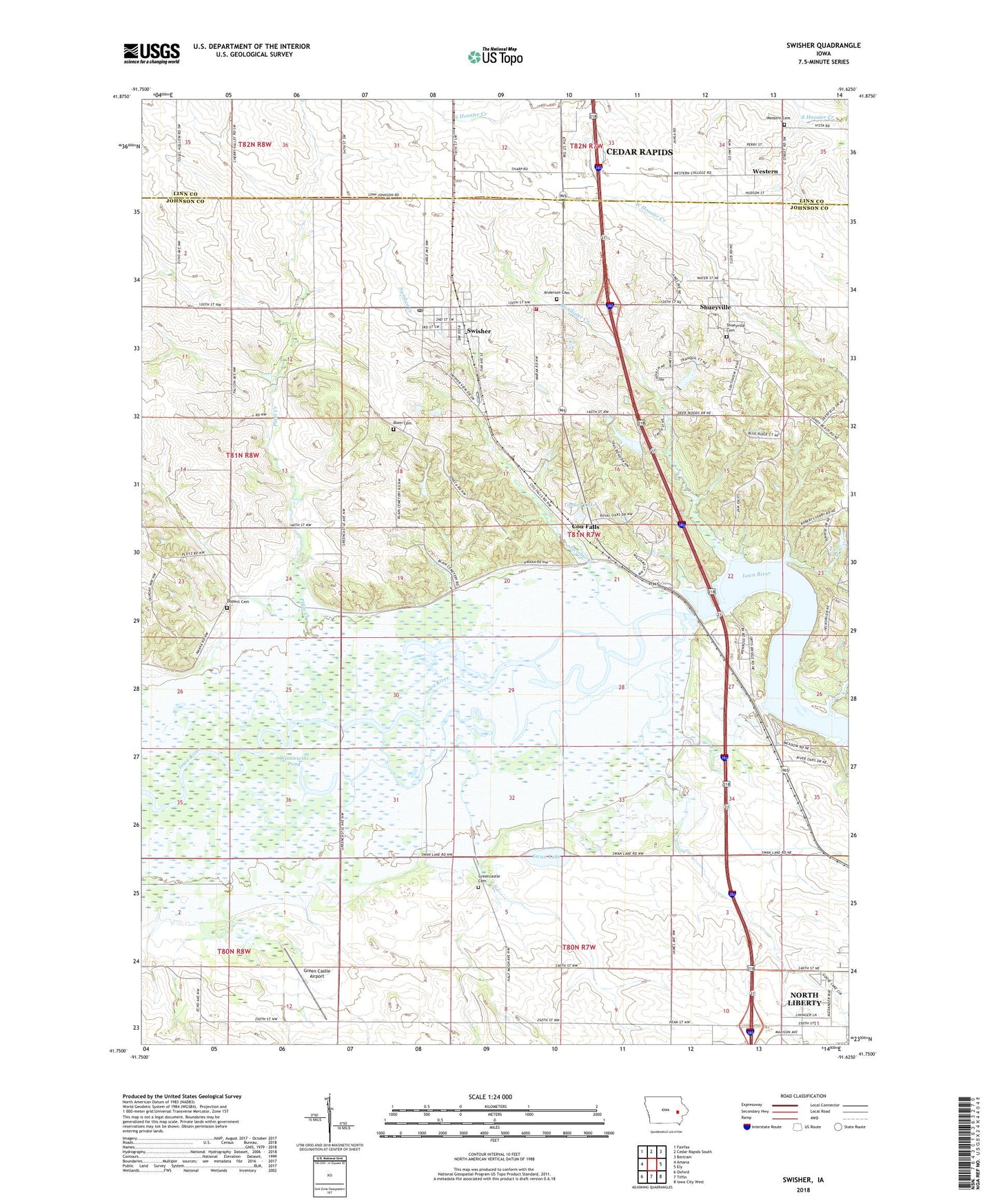
2022 topographic map quadrangle Swisher in the state of Iowa. Scale: 1:24000. Based on the newly updated USGS 7.5' US Topo map series, this map is in the following counties: Johnson, Linn. The map contains contour data, water features, and other items you are used to seeing on USGS maps, but also has updated roads and other features. This is the next generation of topographic maps. Printed on high-quality waterproof paper with UV fade-resistant inks.
Quads adjacent to this one:
West: Amana
Northwest: Fairfax
North: Cedar Rapids South
Northeast: Bertram
East: Ely
Southeast: Iowa City West
South: Tiffin
Southwest: Oxford
This map covers the same area as the classic USGS quad with code o41091g6.
Contains the following named places: Anderson Cemetery, Blain Cemetery, Castek Park, Cedar Rapids North Bound Rest Area, Cedar Rapids South Bound Rest Area, Chase, Chase Post Office, City of Shueyville, City of Swisher, Cou Falls, Cou Falls Post Office, Curtis, Curtis Hill Indian Museum, Curtis Post Office, Dance-Mor Ballroom, Danforth, Dupont Cemetery, Green Castle, Green Castle Airport, Greencastle Cemetery, Gregg Post Office, Hawkeye State Wildlife Area, Jefferson Monroe Fire Department, Lake Lavon, McAllister Creek, Mid River Public Use Area, Plum Creek, Shueyville, Shueyville Cemetery, Shueyville Civic Center, Shueyville Post Office, Shueyville United Methodist Church, Swan Lake, Swan Lake State Wildlife Area, Swisher, Swisher City Hall, Swisher Creek, Swisher Post Office, Timber Lake, Township of Jefferson, Township of Madison, Twin Lake, Walton Picnic Area, Western, Western Cemetery, Western College Post Office, Wisniewski Pond, ZIP Codes: 52317, 52338