
MyTopo
Oxford Iowa US Topo Map
Couldn't load pickup availability
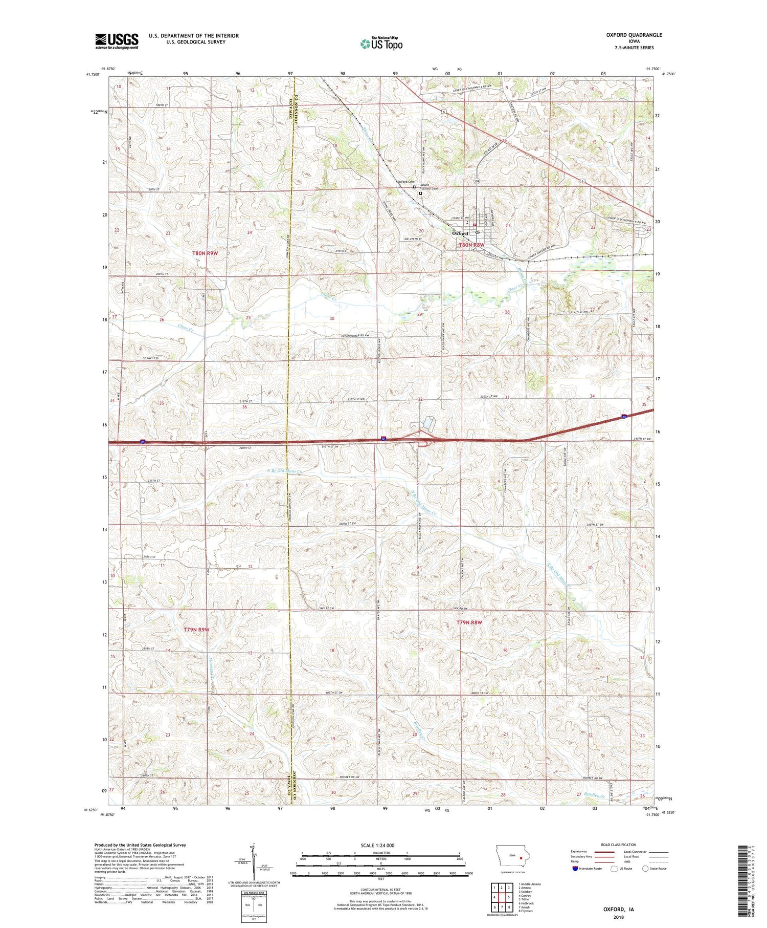
2022 topographic map quadrangle Oxford in the state of Iowa. Scale: 1:24000. Based on the newly updated USGS 7.5' US Topo map series, this map is in the following counties: Johnson, Iowa. The map contains contour data, water features, and other items you are used to seeing on USGS maps, but also has updated roads and other features. This is the next generation of topographic maps. Printed on high-quality waterproof paper with UV fade-resistant inks.
Quads adjacent to this one:
West: Conroy
Northwest: Middle Amana
North: Amana
Northeast: Swisher
East: Tiffin
Southeast: Frytown
South: Amish
Southwest: Holbrook
This map covers the same area as the classic USGS quad with code o41091f7.
Contains the following named places: Anchored in Faith Gospel Church, Boltonville, Boltonville Post Office, City of Oxford, Clear Creek Elementary School, Dakota Mobile Home Park, Mount Calvary Cemetery, Oakland Public Library, Oxford, Oxford Cemetery, Oxford City Hall, Oxford Fire Department, Oxford Post Office, Parkview Mobile Home Park, Rhine Creek, Saint Marys Church, Sleepy Hollow Campground, Township of Hardin, Township of Oxford, United Methodist Church, ZIP Code: 52322


