MyTopo
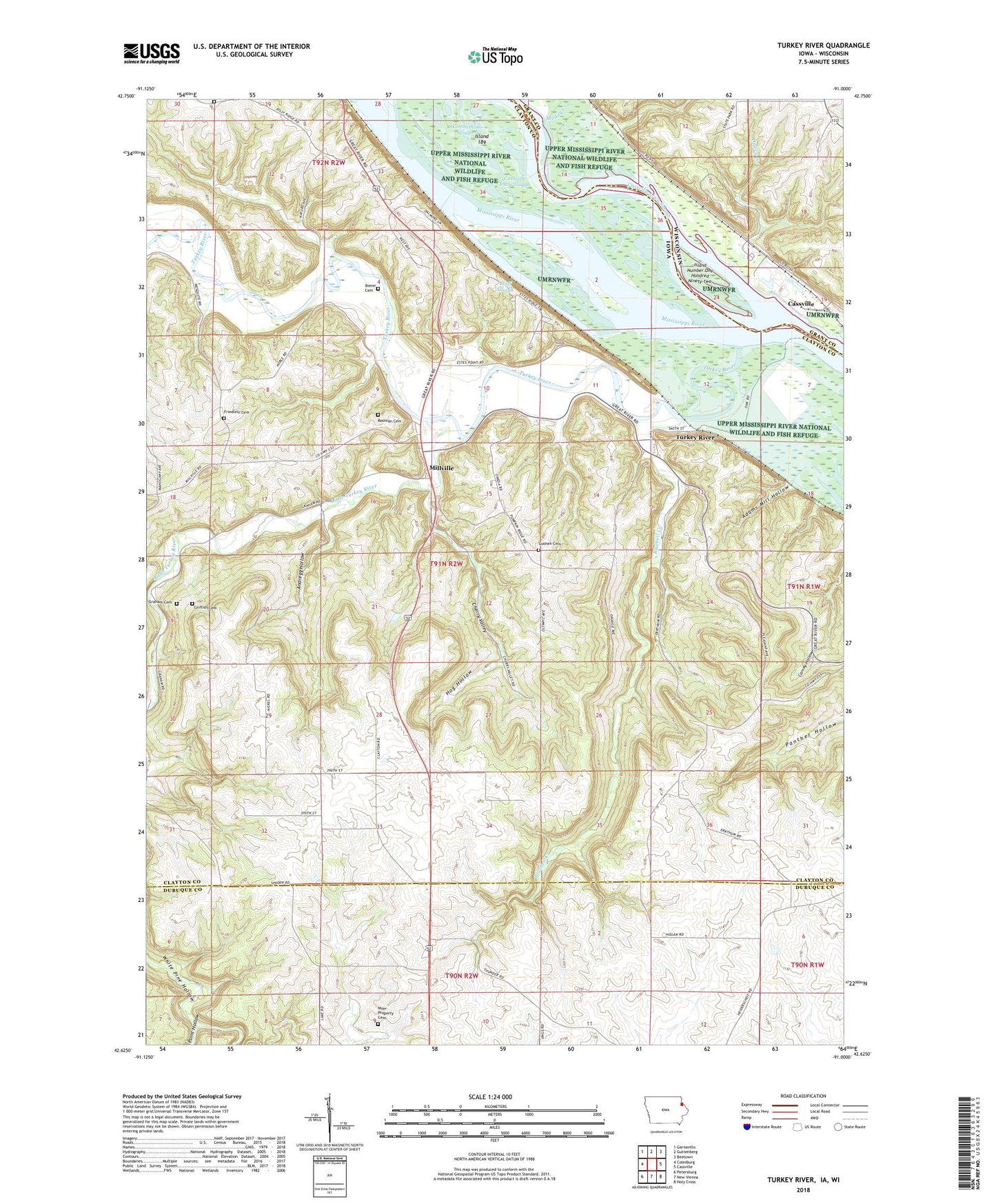
Turkey River Iowa US Topo Map
Couldn't load pickup availability
2022 topographic map quadrangle Turkey River in the states of Iowa, Wisconsin. Scale: 1:24000. Based on the newly updated USGS 7.5' US Topo map series, this map is in the following counties: Clayton, Dubuque, Grant. The map contains contour data, water features, and other items you are used to seeing on USGS maps, but also has updated roads and other features. This is the next generation of topographic maps. Printed on high-quality waterproof paper with UV fade-resistant inks.
Quads adjacent to this one:
West: Colesburg
Northwest: Garnavillo
North: Guttenberg
Northeast: Beetown
East: Cassville
Southeast: Holy Cross
South: New Vienna
Southwest: Petersburg
Contains the following named places: Adams Mill Hollow, Anderson Post Office, Andregg Hollow, Bierer Cemetery, Bluebell Creek, Bluff Slough, Cassville Iowa Slough, Cassville Slough, Cherry Valley, City of Millville, Dewey Creek, Dewey Heights Prairie State Natural Area, Friedlein Cemetery, Furnace Branch, Goshen Cemetery, Goshen Church, Graham Cemetery, Graham Post Office, Griffith Cemetery, Hog Hollow, Island 189, Island Number One Hundred Ninety-two, Little Turkey River, Merritt Forest State Preserve, Millville, Millville Post Office, Muddy Creek, Myer Property Cemetery, Nelson Dewey Generating Station, Nelson Dewey State Park, Peter Holms Historical Marker, Point Hollow, Redman Cemetery, Saint Johns Cemetery, Skimmethom Slough, Spring Lake, Springville, Township of Millville, Turkey River, Turkey River Mounds State Monument, Turkey River Mounds State Preserve, Turkey River Post Office, White Pine Hollow State Park, ZIP Code: 52052