MyTopo
Garnavillo Iowa US Topo Map
Couldn't load pickup availability
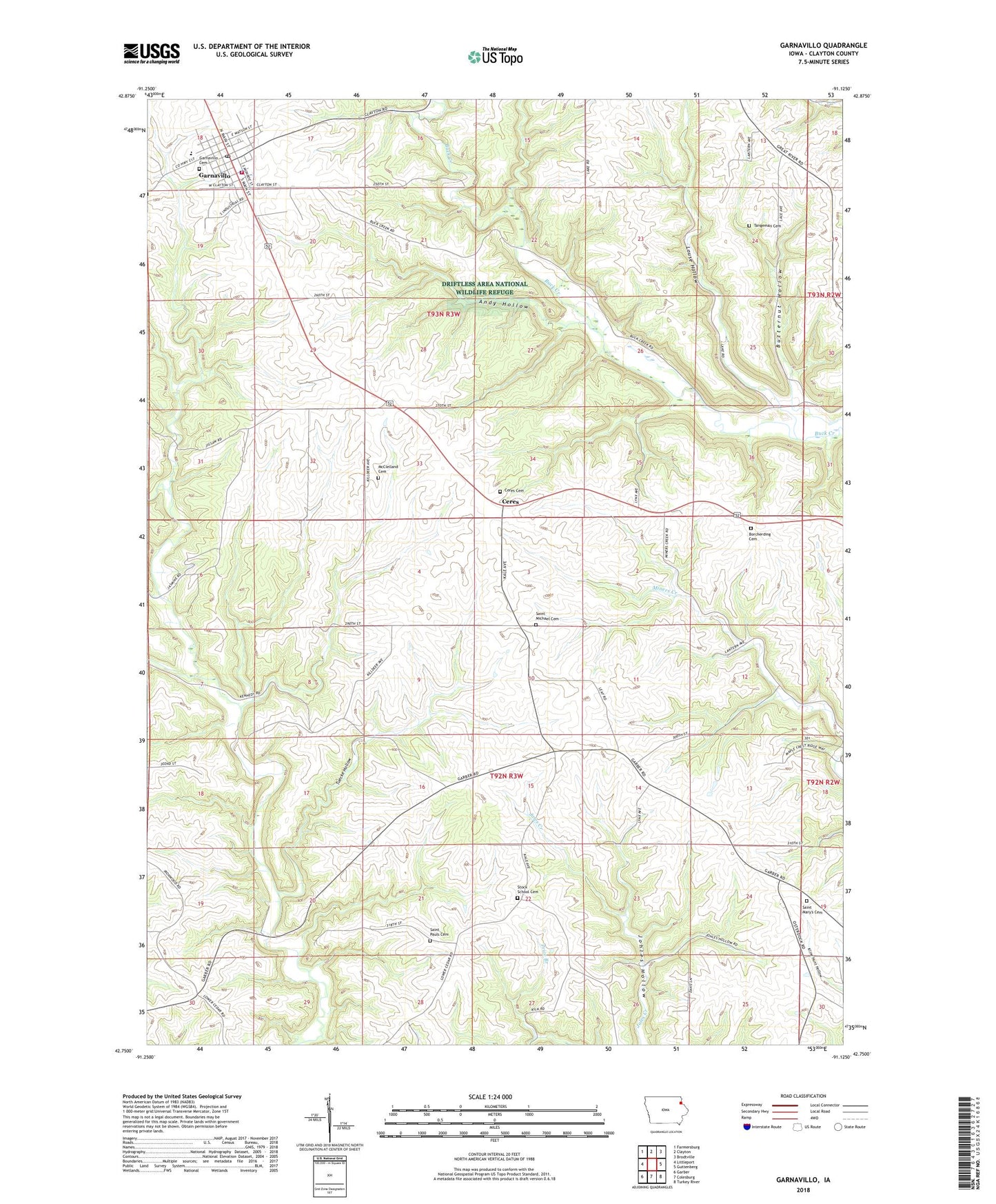
2022 topographic map quadrangle Garnavillo in the state of Iowa. Scale: 1:24000. Based on the newly updated USGS 7.5' US Topo map series, this map is in the following counties: Clayton. The map contains contour data, water features, and other items you are used to seeing on USGS maps, but also has updated roads and other features. This is the next generation of topographic maps. Printed on high-quality waterproof paper with UV fade-resistant inks.
Quads adjacent to this one:
West: Littleport
Northwest: Farmersburg
North: Clayton
Northeast: Brodtville
East: Guttenberg
Southeast: Turkey River
South: Colesburg
Southwest: Garber
This map covers the same area as the classic USGS quad with code o42091g2.
Contains the following named places: Andy Hollow, Borcherding Cemetery, Butternut Hollow, Ceres, Ceres Cemetery, Ceres Church, Ceres Post Office, City of Garnavillo, Clayton Ridge Elementary School, Elkader Medical Associates Office, Family Medicine Associates Center, First Congregational Church, Garnavillo, Garnavillo City Hall, Garnavillo City Park, Garnavillo Community Cemetery, Garnavillo Elementary School, Garnavillo Emergency Medical Services, Garnavillo Fire Department, Garnavillo Gospel Hall, Garnavillo Historical Museum, Garnavillo Police Department, Garnavillo Post Office, Garnavillo Public Library, Kann Cemetery, Louse Hollow, McClelland Cemetery, Panther Creek Post Office, Peace Evangelical Lutheran Church, Saint Josephs Church, Saint Marys Cemetery, Saint Paula Cemetery, Saint Pauls Lutheran Church, Saint Peter Lutheran Church, Stock School Cemetery, Tangeman Cemetery, Township of Garnavillo, Township of Jefferson, Tuecke Hollow, West Branch South Cedar Creek