MyTopo
Vail Iowa US Topo Map
Couldn't load pickup availability
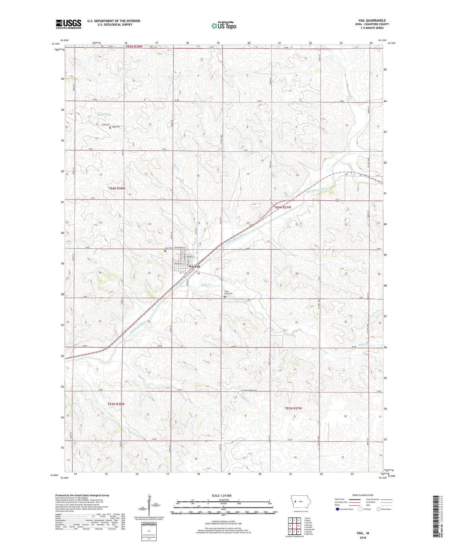
2022 topographic map quadrangle Vail in the state of Iowa. Scale: 1:24000. Based on the newly updated USGS 7.5' US Topo map series, this map is in the following counties: Crawford. The map contains contour data, water features, and other items you are used to seeing on USGS maps, but also has updated roads and other features. This is the next generation of topographic maps. Printed on high-quality waterproof paper with UV fade-resistant inks.
Quads adjacent to this one:
West: Denison
Northwest: Kiron
North: Boyer
Northeast: Vail NE
East: Arcadia
Southeast: Manning
South: Manilla
Southwest: Earling NE
This map covers the same area as the classic USGS quad with code o42095a2.
Contains the following named places: City of Vail, Family Practice and Surgical Center, Hay Creek, Holy Cross School, King Cemetery, King Creek, Lenz Landing Strip, Miller Creek, Presbyterian Church, Saint Anns Catholic Church, Saint Anns Cemetery, Schrader Wildlife Area, Township of West Side, Vail, Vail Cemetery, Vail City Hall, Vail Community Building, Vail Elementary School, Vail Post Office, Vail Volunteer Fire Department, ZIP Code: 51465