MyTopo
Boyer Iowa US Topo Map
Couldn't load pickup availability
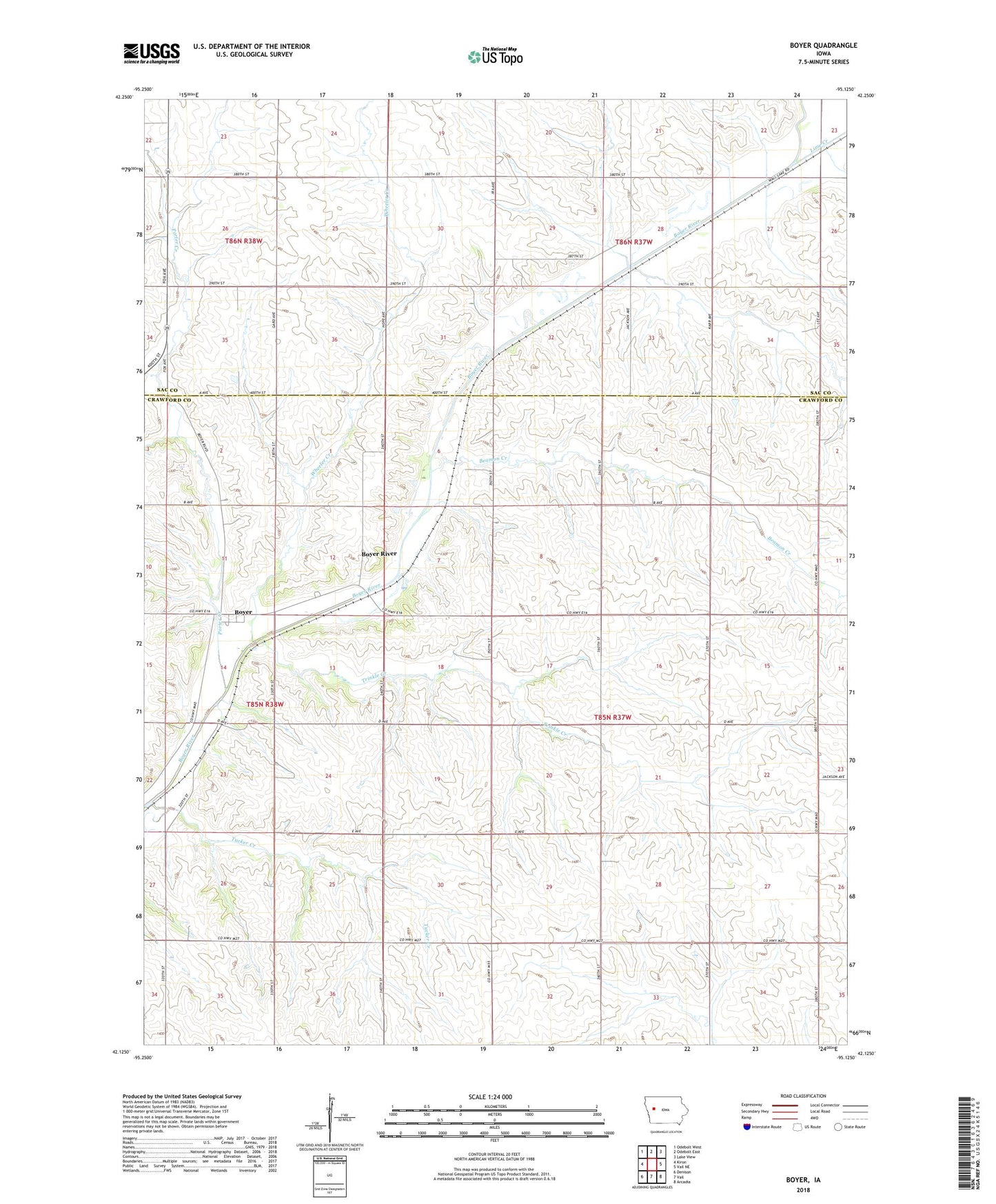
2022 topographic map quadrangle Boyer in the state of Iowa. Scale: 1:24000. Based on the newly updated USGS 7.5' US Topo map series, this map is in the following counties: Crawford, Sac. The map contains contour data, water features, and other items you are used to seeing on USGS maps, but also has updated roads and other features. This is the next generation of topographic maps. Printed on high-quality waterproof paper with UV fade-resistant inks.
Quads adjacent to this one:
West: Kiron
Northwest: Odebolt West
North: Odebolt East
Northeast: Lake View
East: Vail NE
Southeast: Arcadia
South: Vail
Southwest: Denison
This map covers the same area as the classic USGS quad with code o42095b2.
Contains the following named places: Beamon Creek, Boyer, Boyer Post Office, Boyer River, Brogan, Ells Post Office, Ells Station, Glen Pederson Park, Herring, Herring Post Office, Lime Creek, McCloy, Porter Creek, Township of Jackson, Trinkle Creek, Tucker Creek, Wheeler Creek