MyTopo
West Liberty Iowa US Topo Map
Couldn't load pickup availability
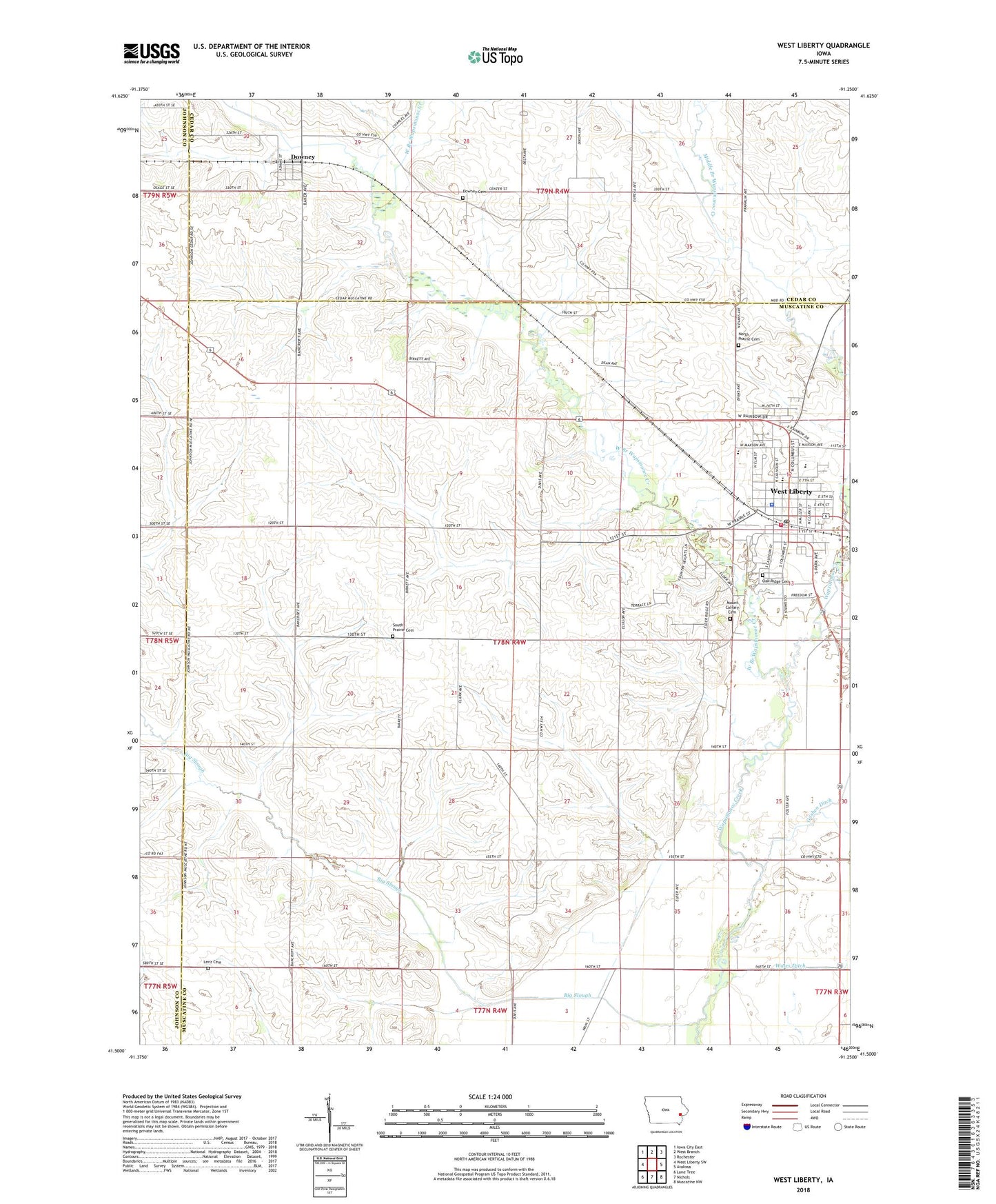
2022 topographic map quadrangle West Liberty in the state of Iowa. Scale: 1:24000. Based on the newly updated USGS 7.5' US Topo map series, this map is in the following counties: Muscatine, Cedar, Johnson. The map contains contour data, water features, and other items you are used to seeing on USGS maps, but also has updated roads and other features. This is the next generation of topographic maps. Printed on high-quality waterproof paper with UV fade-resistant inks.
Quads adjacent to this one:
West: West Liberty SW
Northwest: Iowa City East
North: West Branch
Northeast: Rochester
East: Atalissa
Southeast: Muscatine NW
South: Nichols
Southwest: Lone Tree
This map covers the same area as the classic USGS quad with code o41091e3.
Contains the following named places: Big Slough, City of West Liberty, Downey, Downey Cemetery, Downey Census Designated Place, Downey Post Office, Faith Baptist Church, First Church United, Independent Pentecostal Church, Kimberly Park, Lenz Cemetery, Mount Calvary Cemetery, North Prairie Cemetery, Oak Ridge Cemetery, Our Redeemer Lutheran Church, Rock Island Depot, Saint Joseph Church, Simpson Memorial Home, South Prairie Cemetery, South Prairie Grange Hall, The Church of Jesus Christ of Latter Day Saints, Township of Wapsinonoc, Wapsie Park, West Branch Wapsinonoc Creek, West Liberty, West Liberty Christian Church, West Liberty City Hall, West Liberty Country Club, West Liberty Elementary School, West Liberty High School, West Liberty Library, West Liberty Middle School, West Liberty Police Department, West Liberty Post Office, West Liberty United Methodist Church, West Liberty Volunteer Fire Department, ZIP Code: 52776