MyTopo
Nichols Iowa US Topo Map
Couldn't load pickup availability
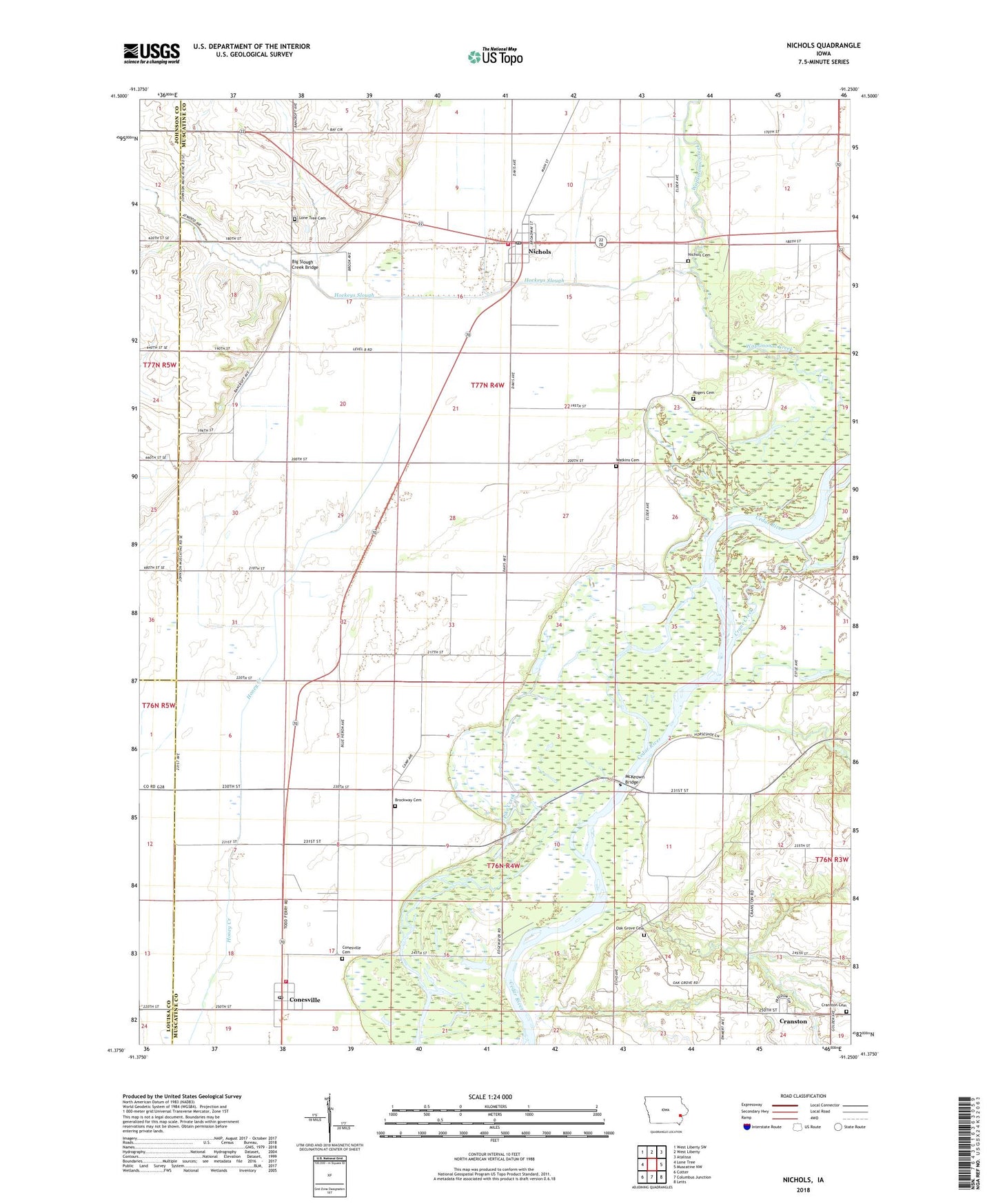
2022 topographic map quadrangle Nichols in the state of Iowa. Scale: 1:24000. Based on the newly updated USGS 7.5' US Topo map series, this map is in the following counties: Muscatine, Johnson, Louisa. The map contains contour data, water features, and other items you are used to seeing on USGS maps, but also has updated roads and other features. This is the next generation of topographic maps. Printed on high-quality waterproof paper with UV fade-resistant inks.
Quads adjacent to this one:
West: Lone Tree
Northwest: West Liberty SW
North: West Liberty
Northeast: Atalissa
East: Muscatine NW
Southeast: Letts
South: Columbus Junction
Southwest: Cotter
This map covers the same area as the classic USGS quad with code o41091d3.
Contains the following named places: Big Slough Creek Bridge, Brockway Cemetery, Christian Church, Church of Saint Mary, City of Conesville, City of Nichols, Cone Lake, Conesville, Conesville Cemetery, Conesville City Hall, Conesville Post Office, Conesville United Methodist Church, Conesville Volunteer Fire Department, Crane Creek, Cranston, Cranston Cemetery, Cranston Post Office, Gedney Lake Area, Hockeys Slough, Lacey Post Office, Lone Tree Cemetery, McKeown Bridge, McKeown Bridge River Access, Myrtle Post Office, Nichols, Nichols Cemetery, Nichols City Hall, Nichols Fire Department, Nichols Post Office, Oak Grove Cemetery, Pike Post Office, Red Cedar Wildlife Area, Township of Orono, Township of Pike, United Methodist Church, Wapsinonoc Creek, Watkins Cemetery, Wesson Cemetery, ZIP Code: 52766