MyTopo
Yale Iowa US Topo Map
Couldn't load pickup availability
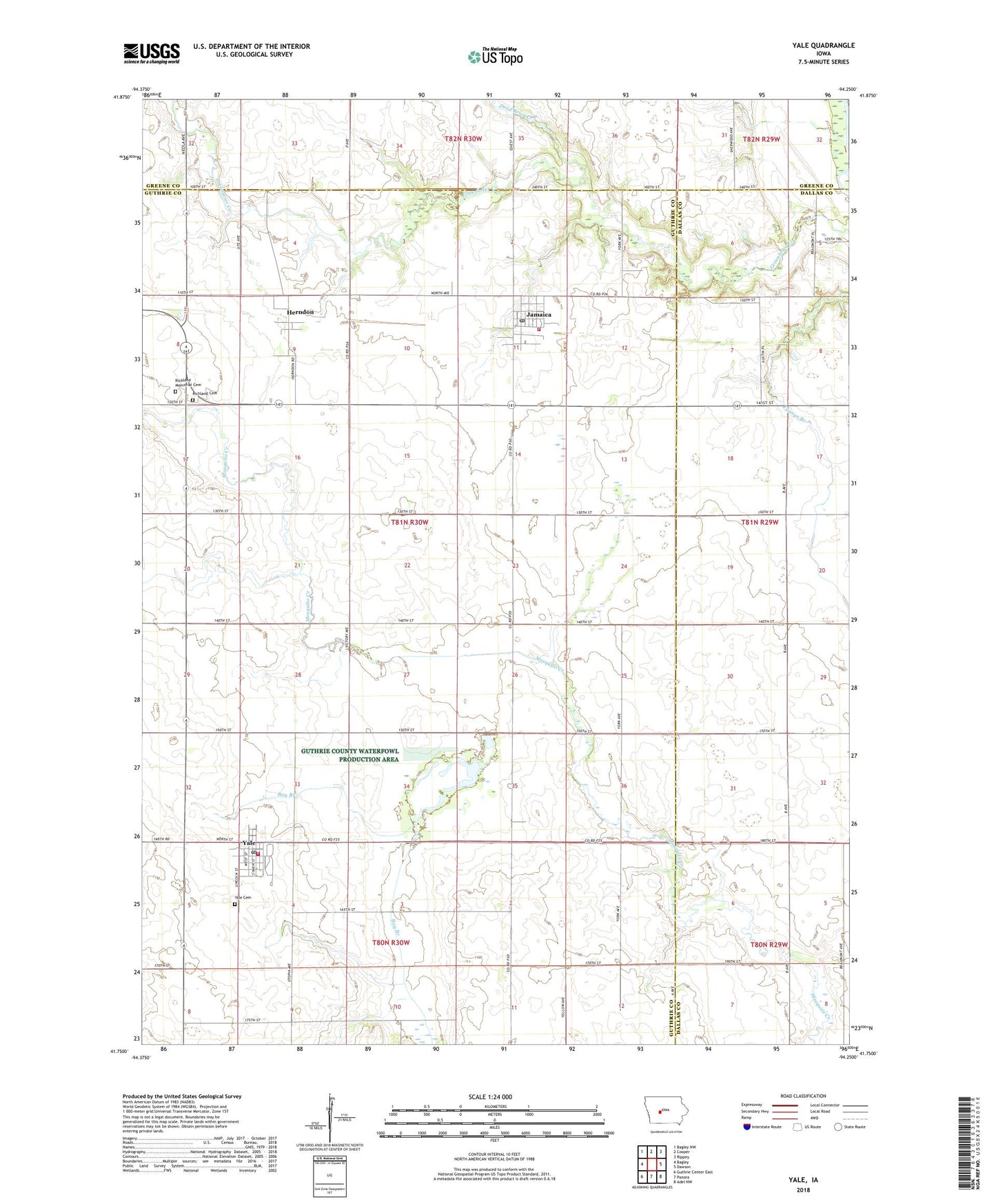
2022 topographic map quadrangle Yale in the state of Iowa. Scale: 1:24000. Based on the newly updated USGS 7.5' US Topo map series, this map is in the following counties: Guthrie, Dallas, Greene. The map contains contour data, water features, and other items you are used to seeing on USGS maps, but also has updated roads and other features. This is the next generation of topographic maps. Printed on high-quality waterproof paper with UV fade-resistant inks.
Quads adjacent to this one:
West: Bagley
Northwest: Bagley NW
North: Cooper
Northeast: Rippey
East: Dawson
Southeast: Adel NW
South: Panora
Southwest: Guthrie Center East
This map covers the same area as the classic USGS quad with code o41094g3.
Contains the following named places: Advance Post Office, Church of Christ, City of Jamaica, City of Yale, Dead Brier Creek, Herndon, Herndon Post Office, Jamaica, Jamaica City Hall, Jamaica Fire Department, Jamaica Library, Jamaica Post Office, Jamaica Union Church, Lakin Slough State Game Management Area, Messenger Cemetery, Methodist Church, Panorama Elementary School, Richland Cemetery, Richland Memorial Cemetery, Township of Richland, Yale, Yale Cemetery, Yale City Hall, Yale Post Office, Yale Volunteer Fire Department, ZIP Codes: 50128, 50277