MyTopo
Adel NW Iowa US Topo Map
Couldn't load pickup availability
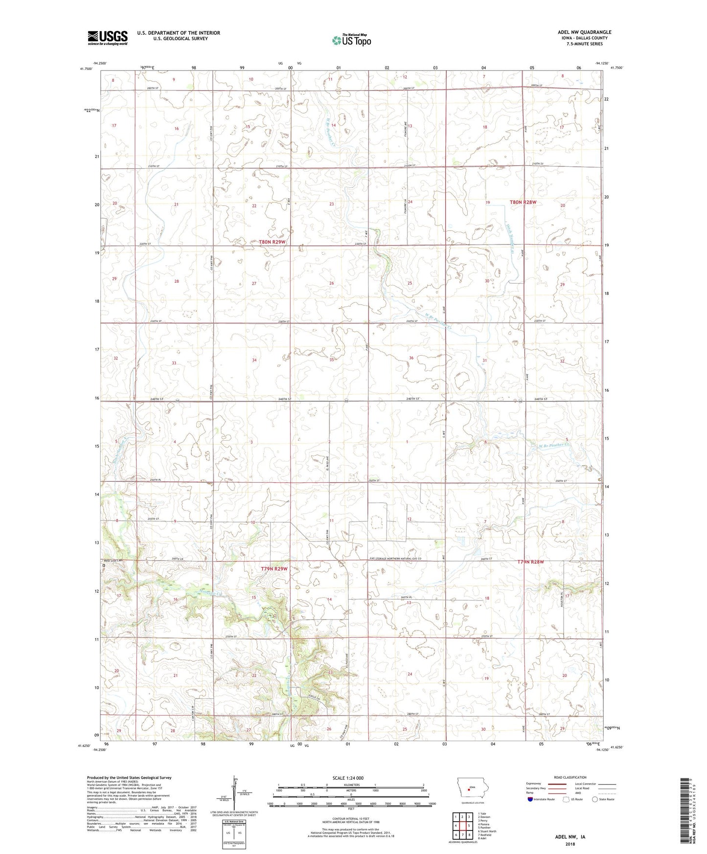
2022 topographic map quadrangle Adel NW in the state of Iowa. Scale: 1:24000. Based on the newly updated USGS 7.5' US Topo map series, this map is in the following counties: Dallas. The map contains contour data, water features, and other items you are used to seeing on USGS maps, but also has updated roads and other features. This is the next generation of topographic maps. Printed on high-quality waterproof paper with UV fade-resistant inks.
Quads adjacent to this one:
West: Panora
Northwest: Yale
North: Dawson
Northeast: Perry
East: Panther
Southeast: Adel
South: Redfield
Southwest: Stuart North
This map covers the same area as the classic USGS quad with code o41094f2.
Contains the following named places: Brough, Brough Post Office, Ditch Number 4, Ditch Number 41, Ephesus Post Office, Greenvale, Greenvale Post Office, Langfitt Post Office, Lincoln Center School, Lincoln Community Center, Shiloh Bible Church, Township of Lincoln, Township of Linn, West Linn Cemetery, ZIP Code: 50146