MyTopo
Allen SE Kansas US Topo Map
Couldn't load pickup availability
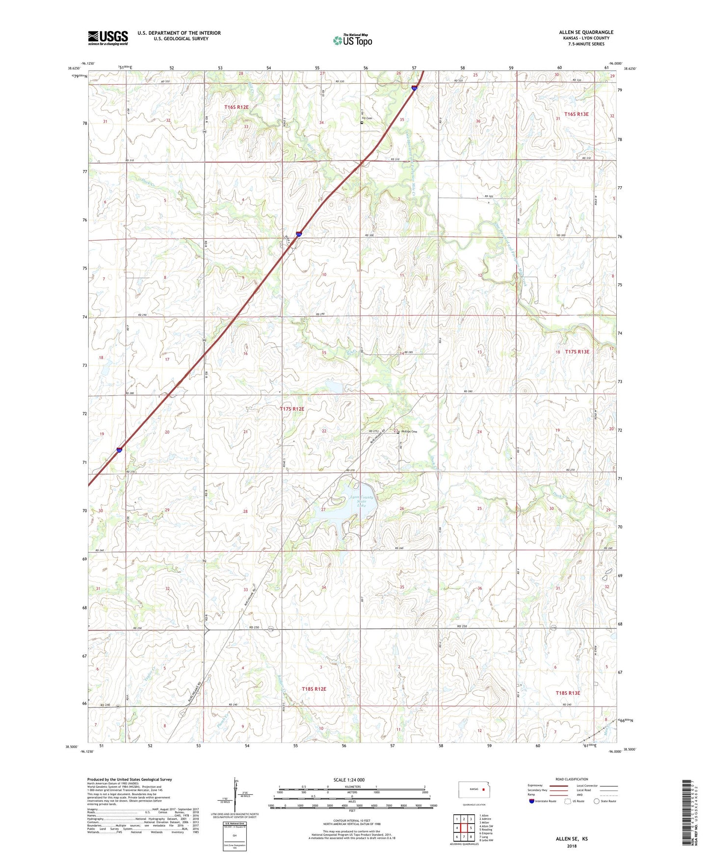
2022 topographic map quadrangle Allen SE in the state of Kansas. Scale: 1:24000. Based on the newly updated USGS 7.5' US Topo map series, this map is in the following counties: Lyon. The map contains contour data, water features, and other items you are used to seeing on USGS maps, but also has updated roads and other features. This is the next generation of topographic maps. Printed on high-quality waterproof paper with UV fade-resistant inks.
Quads adjacent to this one:
West: Allen SW
Northwest: Allen
North: Admire
Northeast: Miller
East: Reading
Southeast: Lebo NW
South: Lang
Southwest: Emporia
This map covers the same area as the classic USGS quad with code o38096e1.
Contains the following named places: Eby Ranch, Evans Farm, Fehr Farms, Hill Creek, Ivy Cemetery, Lynn State Fishing Lake and Wildlife Area, Lyon County State Lake, Lyon County State Lake Dam, Phillips Cemetery, Township of Reading, ZIP Code: 66830