MyTopo
Reading Kansas US Topo Map
Couldn't load pickup availability
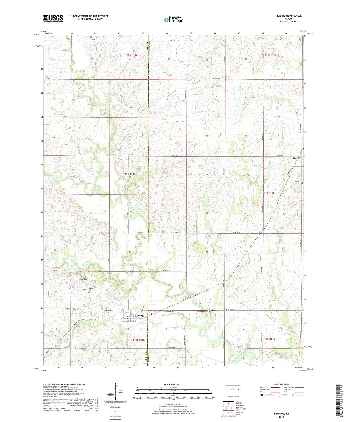
2022 topographic map quadrangle Reading in the state of Kansas. Scale: 1:24000. Based on the newly updated USGS 7.5' US Topo map series, this map is in the following counties: Osage, Lyon. The map contains contour data, water features, and other items you are used to seeing on USGS maps, but also has updated roads and other features. This is the next generation of topographic maps. Printed on high-quality waterproof paper with UV fade-resistant inks.
Quads adjacent to this one:
West: Allen SE
Northwest: Admire
North: Miller
Northeast: Osage City
East: Osage City SE
Southeast: Lebo
South: Lebo NW
Southwest: Lang
This map covers the same area as the classic USGS quad with code o38095e8.
Contains the following named places: Arvonia, Barclay, Barclay Cemetery, City of Reading, Duck Creek, Elm Creek, First Baptist Church, KZOC-FM (Osage City), Morse Creek, Mount Calvary Cemetery, Mud Creek, One Hundred and Fortytwo Mile Creek, Reading, Reading Benefit Fire District 1, Reading Cemetery, Reading Elementary School, Reading Grain and Lumber Grain Elevator Number 1, Reading Post Office, Reading Sewer Treatment Plant, Reading United Methodist Church, Standifred Creek, Township of Barclay, ZIP Code: 66868