MyTopo
Alton Kansas US Topo Map
Couldn't load pickup availability
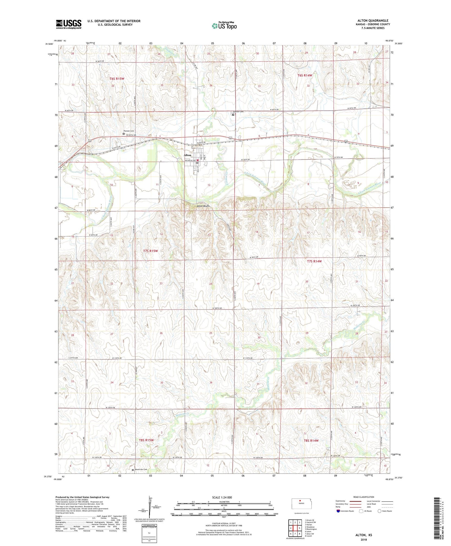
2022 topographic map quadrangle Alton in the state of Kansas. Scale: 1:24000. Based on the newly updated USGS 7.5' US Topo map series, this map is in the following counties: Osborne. The map contains contour data, water features, and other items you are used to seeing on USGS maps, but also has updated roads and other features. This is the next generation of topographic maps. Printed on high-quality waterproof paper with UV fade-resistant inks.
Quads adjacent to this one:
West: Woodston
Northwest: Kirwin SE
North: Gaylord SW
Northeast: Harlan
East: Bloomington
Southeast: Covert
South: Alton SW
Southwest: Laton
This map covers the same area as the classic USGS quad with code o39098d8.
Contains the following named places: Alton, Alton Bluffs, Alton Elementary School, Alton Post Office, Alton United Methodist Church, Alton Wastewater Plant, Alton-Osborne Junior High School, City of Alton, Crooked Creek, Kill Creek Church, Midway Co - Operative Association Grain Elevator Number 2, Mount Ayr Cemetery, Mount Ayr Friends Church, Mount Ayr School, Osborne Canal, Osborne County Rural Fire District Station 3, Pioneer Cemetery, Skunk Creek, Sumner Cemetery, Township of Sumner, ZIP Code: 67623