MyTopo
Ashland Kansas US Topo Map
Couldn't load pickup availability
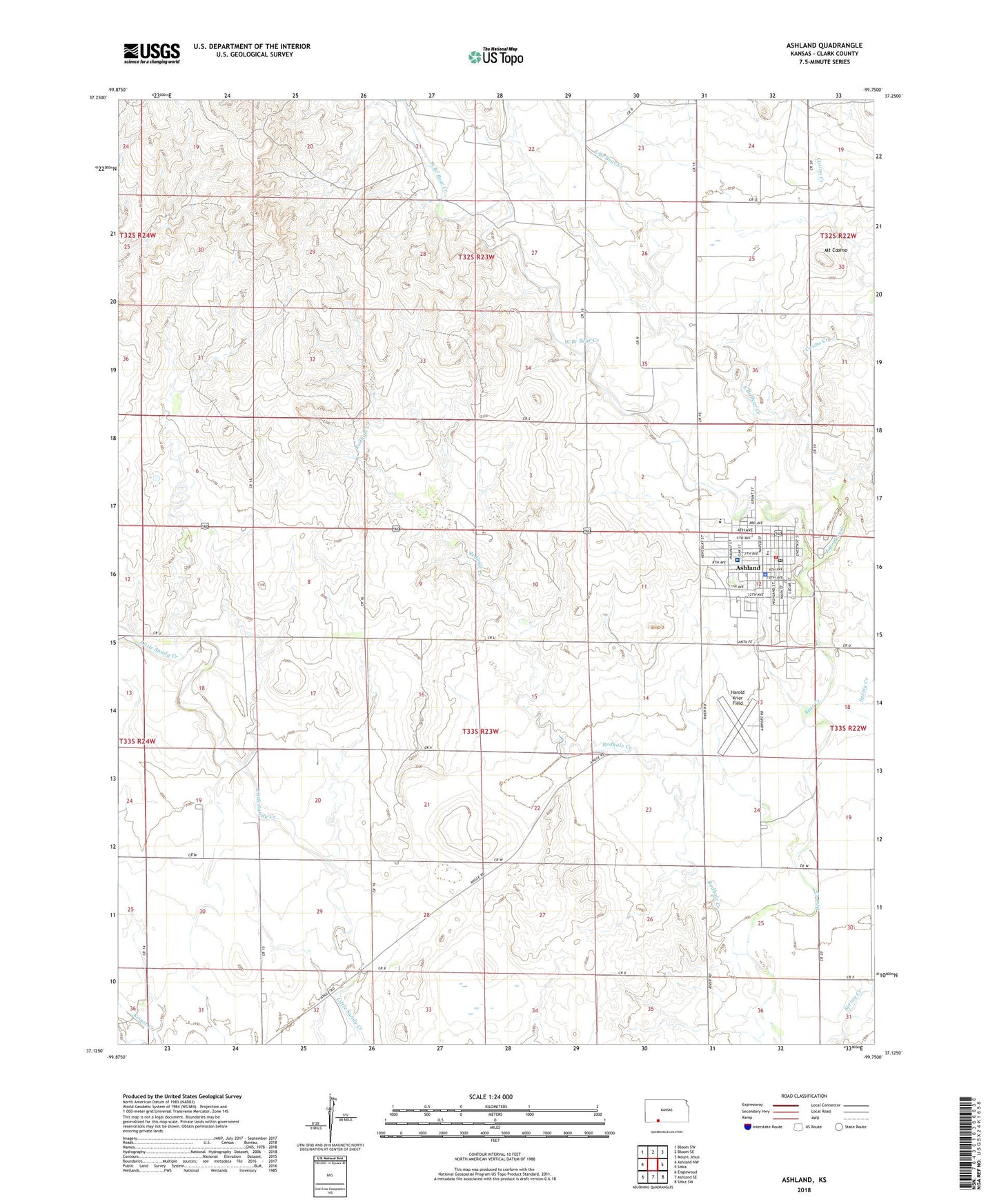
2022 topographic map quadrangle Ashland in the state of Kansas. Scale: 1:24000. Based on the newly updated USGS 7.5' US Topo map series, this map is in the following counties: Clark. The map contains contour data, water features, and other items you are used to seeing on USGS maps, but also has updated roads and other features. This is the next generation of topographic maps. Printed on high-quality waterproof paper with UV fade-resistant inks.
Quads adjacent to this one:
West: Ashland NW
Northwest: Bloom SW
North: Bloom SE
Northeast: Mount Jesus
East: Sitka
Southeast: Sitka SW
South: Ashland SE
Southwest: Englewood
This map covers the same area as the classic USGS quad with code o37099b7.
Contains the following named places: Ashland, Ashland City Hall, Ashland Community Center, Ashland Country Club, Ashland Elementary School, Ashland Fire Department, Ashland Health Center, Ashland Junior High School, Ashland Junior Senior High School, Ashland Library, Ashland Municipal Power Plant, Ashland Oil Field, Ashland Post Office, Ashland United Methodist Church, Ashland Wastewater Treatment Facility, Casino Creek, City of Ashland, Clark County, Clark County Courthouse, Clark County Fairgrounds, Clark County Health Department, Clark County Jail, Clark County Sheriff's Office, East Branch Bear Creek, Farmers Co - Operative Grain Elevator Number 2, First Baptist Church, First Christian Church, First Church of God, First Presbyterian Church, Harold Krier Field, Lighthouse Assembly of God Church, Mount Casino, Pioneer - Krier Museum, Redhole Creek, Saint Joseph's Catholic Church, Township of Center, West Branch Bear Creek, ZIP Code: 67831