MyTopo
Assaria Kansas US Topo Map
Couldn't load pickup availability
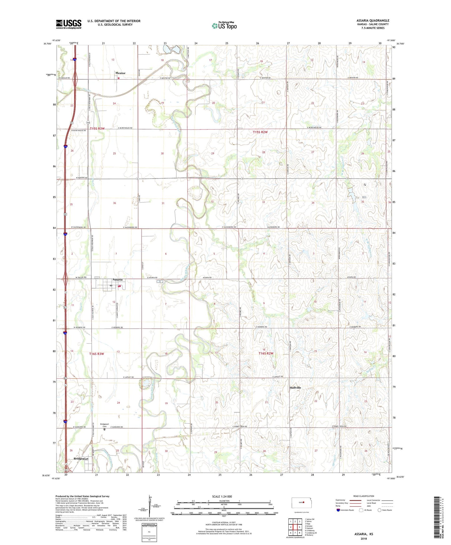
2022 topographic map quadrangle Assaria in the state of Kansas. Scale: 1:24000. Based on the newly updated USGS 7.5' US Topo map series, this map is in the following counties: Saline. The map contains contour data, water features, and other items you are used to seeing on USGS maps, but also has updated roads and other features. This is the next generation of topographic maps. Printed on high-quality waterproof paper with UV fade-resistant inks.
Quads adjacent to this one:
West: Smolan
Northwest: Salina SW
North: Salina
Northeast: Kipp
East: Gypsum
Southeast: Roxbury
South: Lindsborg SE
Southwest: Lindsborg
This map covers the same area as the classic USGS quad with code o38097f5.
Contains the following named places: Assaria, Assaria City Fire Department, Assaria Lutheran Church, Assaria Police Department, Assaria Post Office, Assaria Wastewater Facility, Berwick, Bridgeport, Bridgeport Census Designated Place, City of Assaria, Hallville, Lakeside Recreational Park, Mentor, Mentor Census Designated Place, Mentor United Methodist Church, Pewee Creek, River Bend Golf Course, Salemsborg Lutheran Cemetery, Saline County Fire District 2 - Assaria Station, Saline County Fire District 2 - Mentor Station, Smokey Valley Mobile Home Park, Southeast Saline Elementary School, Southeast Saline High School, Summit Hill School, Team Marketing Alliance Grain Elevator Number 4, Torry, Township of Liberty, Township of Walnut, Wheeler School, ZIP Code: 67416